
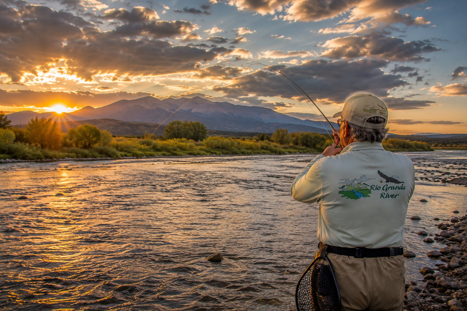
There comes a point on every great river where the country opens up.
For the Rio Grande River, that moment arrives below South Fork, Colorado.
Upstream, we have followed a young mountain river from its beginnings in the San Juan Mountains, through Rio Grande Reservoir, past Creede, Wagon Wheel Gap and the Palisades, and down to South Fork. Mountains have crowded close to the water. Cold tributaries have tumbled out of forested canyons. Brown and rainbow trout have occupied deep pools, undercut banks and current seams.
Then, downstream from South Fork, something changes.
The mountains begin backing away.
The horizon grows.
The Rio Grande enters the enormous San Luis Valley, one of the great high-altitude valleys of the American West.
I have always been drawn to country like this.
Growing up on cattle ranches in the Kansas Flint Hills taught me to appreciate an open horizon. Later, after Paulette and I built our mountain home at Angel Fire, New Mexico, I learned to love the opposite as well: mountains rising around a valley and snow collecting on peaks that would eventually send water downhill.
The San Luis Valley somehow gives a fellow both.
There are miles of open country beneath an enormous Colorado sky, but mountains stand guard in nearly every direction.
The Rio Grande threads quietly through the middle of it.
For this chapter of my journey down the Rio Grande River, we will begin at South Fork, follow the river east through Del Norte and Monte Vista, continue toward Alamosa, then explore the broader river country associated with the southern San Luis Valley and historic San Luis, Colorado.
And right up front, there is a geographical point worth making.
The town of San Luis is not directly on the Rio Grande. It lies east of the river in Costilla County, near Culebra Creek and the Sangre de Cristo Mountains. But historically, culturally and hydrologically, San Luis belongs to the greater Rio Grande world.
That makes this a story about more than a channel of water.
It is a story about an entire valley.
The Rio Grande River Leaves South Fork
South Fork sits at the confluence of the South Fork of the Rio Grande and the main Rio Grande River.
It is an appropriate place for the river to begin changing character.
Upstream, the Rio Grande is very much a mountain stream.
Below South Fork, the valley broadens as the river heads toward Del Norte.
The gradient gradually decreases.
Longer runs replace some of the steeper mountain water.
Cottonwoods and willows become increasingly important along the banks.
Agricultural land begins appearing.
Irrigation diversions become part of the river's story.
By the time the Rio Grande reaches the central San Luis Valley, it looks considerably different from the river we left above Creede.
Same river.
Different personality.
For a look at the mountain country immediately upstream, my article about the Rio Grande River from Creede to South Fork Colorado provides the previous chapter in this journey.
The San Luis Valley: A Landscape Built on an Enormous Scale
The San Luis Valley is one of those places photographs have difficulty explaining.
It is roughly 8,000 feet above sea level, extraordinarily broad and surrounded by mountains.
To the west rise the San Juan Mountains.
To the east stand the Sangre de Cristo Mountains.
The Rio Grande runs across the valley floor between them.
The result is a landscape with a horizon so broad that weather becomes part of the scenery.
You can watch a thunderstorm develop miles away.
Cloud shadows travel across the valley.
Snow-covered peaks appear to float above distant fields.
And on a clear morning, the light has a sharpness that photographers come to treasure.
The valley is part of the Rio Grande Rift, a major geological feature where Earth's crust has been stretching and faulting for millions of years.
That geology helped create the broad basin through which today's river flows.
The Rio Grande didn't merely happen to find the San Luis Valley.
The geology gave it a road.
From South Fork to Del Norte
Leaving South Fork, the Rio Grande flows generally east toward Del Norte.
This remains productive trout country.
The river is broader than it was upstream, but there is still plenty of classic trout structure.
Look for:
deep bends,
undercut banks,
riffle-to-pool transitions,
current seams,
willow-lined edges,
submerged logs,
boulder pockets,
and deeper runs.
Brown trout are particularly good at finding places where current delivers food without requiring them to burn much energy.
I have always admired that efficiency.
The older I get, the more I appreciate anything that accomplishes a day's work without unnecessary movement.
Feeder Tributaries of the Rio Grande
A river is really a family tree drawn in water.
The Rio Grande arriving at South Fork already contains water from numerous mountain tributaries.
The South Fork Rio Grande joins the main river at South Fork itself.
Moving across the San Luis Valley, additional creeks, irrigation returns, groundwater connections and drainage systems influence the river.
Among important waterways in the broader valley are the Conejos River, Alamosa River, La Jara Creek, Trinchera Creek, Culebra Creek and numerous smaller streams.
Not all enter the Rio Grande at the same place or behave in the same manner.
The Conejos River, however, is particularly important. It drains a substantial portion of the southern San Juan Mountains before joining the Rio Grande south of Alamosa.
That confluence is one of the major hydrological events on the Rio Grande's Colorado journey.
By then, the little headwaters stream we first encountered high above Creede has become a considerably larger river.
Lakes and Reservoirs Connected to the Rio Grande Watershed
The San Luis Valley contains a fascinating collection of lakes, reservoirs, wetlands and irrigation systems.
Some lie directly within the Rio Grande drainage.
Others occupy closed portions of the greater valley basin.
That distinction matters.
Not every lake visible on a San Luis Valley map drains directly into the Rio Grande.
Among the important reservoirs and lakes associated with the greater watershed are Rio Grande Reservoir far upstream, Beaver Creek Reservoir, Terrace Reservoir on the Alamosa River, and numerous smaller agricultural reservoirs.
Then there are the remarkable wetlands and shallow lakes of the valley floor.
These waters are enormously important to migratory birds.
The San Luis Valley is not simply trout country.
It is bird country on a continental scale.
Water Levels: Snowpack Still Rules the Story
Although we are now well below the high mountain headwaters, snow remains one of the principal authors of the Rio Grande's annual story.
Winter storms deposit snow in the San Juan Mountains.
Spring warmth melts it.
Tributaries rise.
The Rio Grande swells.
Peak runoff generally occurs in late spring or early summer, although timing varies dramatically from year to year.
By midsummer, flows usually decline.
Irrigation diversions also become increasingly important across the agricultural valley.
Reservoir operations affect water availability.
Summer thunderstorms may temporarily increase flows in tributaries.
Drought can reduce everything.
That is why anyone fishing, floating or photographing the river should check current stream gauges before leaving home.
Never assume that a river you crossed last July will behave the same way this July.
Western rivers have long memories and short tempers.
Ancient People and the Rio Grande
The San Luis Valley has been used by human beings for thousands of years.
Long before modern highways crossed the valley, Indigenous peoples hunted, traveled and camped here.
The Ute people have especially deep associations with this country.
Other Indigenous groups also traveled through the region over time.
The valley offered water, game, plants and natural travel corridors through mountain passes.
The Rio Grande was part of that landscape.
So were its tributaries.
To ancient travelers, rivers were not recreational destinations.
They were infrastructure.
They told you where animals might be found.
They provided drinking water.
They supported vegetation.
They helped define travel routes.
Later, Spanish and Hispano settlement transformed parts of the southern valley through agriculture and community irrigation.
That brings us to San Luis.
San Luis Colorado: A Remarkable Piece of Rio Grande History
San Luis, Colorado, is one of the most historically significant communities in the state.
Founded in 1851, San Luis is widely recognized as Colorado's oldest continuously inhabited town.
Its history is deeply connected with Hispano settlement moving northward from New Mexico.
That cultural connection is immediately recognizable to anyone familiar with northern New Mexico.
The architecture.
The place names.
The agricultural traditions.
The Catholic heritage.
The acequias.
The relationship between village, mountain and water.
For Paulette and me, after so many years in northern New Mexico, this landscape feels culturally familiar.
San Luis lies along Culebra Creek, east of the main Rio Grande channel.
That tributary country is part of the greater southern San Luis Valley watershed.
Water was essential to the community from the beginning.
Acequias: Water as Community
Few Western institutions illustrate the relationship between people and water better than an acequia.
An acequia is much more than an irrigation ditch.
Traditionally, it is a community system.
Water is shared.
Ditches must be maintained.
Neighbors cooperate.
Rules develop around scarcity.
Responsibility accompanies the right to use water.
Those traditions came north from Spanish and Mexican settlements and became deeply rooted in southern Colorado and northern New Mexico.
Growing up in ranch country gave me an appreciation for that sort of arrangement.
When water is abundant, people can afford to ignore one another.
When water is scarce, cooperation becomes considerably more important.
The Rio Grande has been teaching that lesson for centuries.
Trout Fishing Below South Fork
The river between South Fork and Del Norte remains one of Colorado's respected trout fisheries.
Brown trout are the dominant game fish in much of the river.
Rainbow trout are also present.
Cutthroat trout occur within the broader watershed, particularly in suitable tributary and restoration waters.
As the Rio Grande moves farther into the valley and water temperatures increase, the fish community gradually changes.
That transition is worth remembering.
The Rio Grande is not a trout stream for all 1,900 miles.
It begins as one.
Reading the River
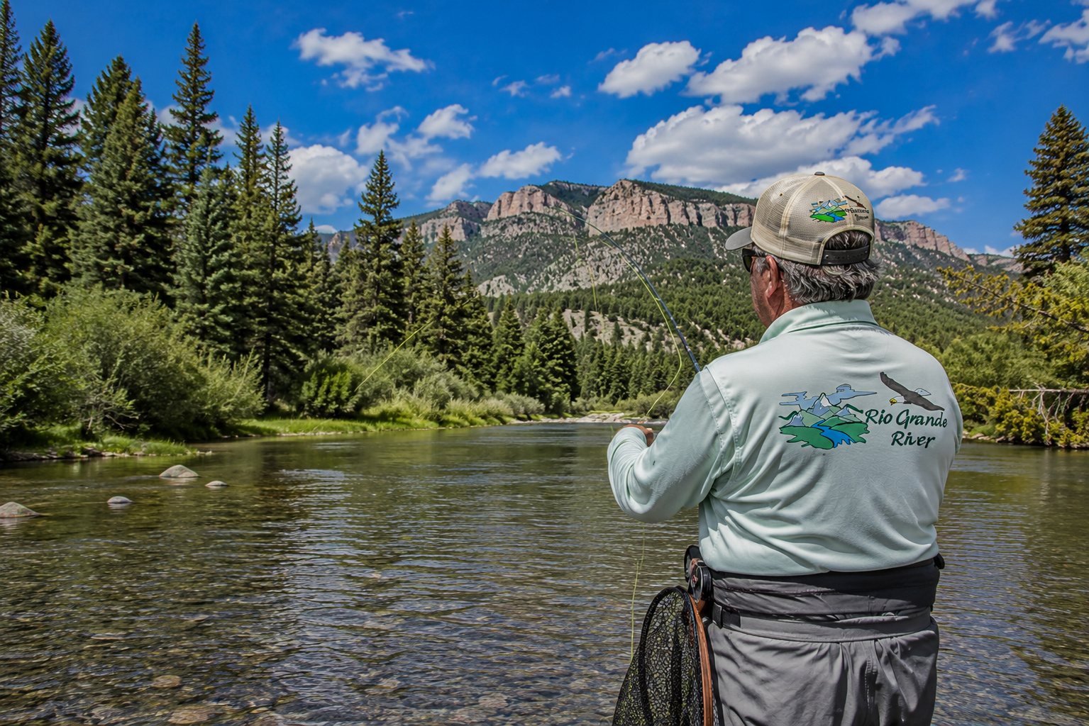
Trout tell you where to fish if you learn to read water.
A fast riffle dumps food into the head of a pool.
Fish it.
A boulder divides current and creates a soft pocket behind it.
Fish it.
Fast water runs beside slow water.
Fish the seam.
A willow-lined bank has been undercut by current.
Approach carefully.
There may be a brown trout living underneath.
Deep bends are particularly interesting.
The outside bend generally carries faster current and scours deeper water.
That creates excellent holding habitat.
My Spinning Rod Choice
For general trout fishing between South Fork and Del Norte, I would carry a 6½- to 7-foot light-action spinning rod.
Match it with a 1000- to 2500-size spinning reel possessing a good drag.
There is no reason to overpower these fish.
Light tackle makes casting small lures easier and allows trout to demonstrate why we enjoy catching them.
Spinning Line
My basic choices remain uncomplicated.
4- to 6-pound monofilament is excellent.
Fluorocarbon works well in clear water.
Thin braid connected to a 4- to 6-pound fluorocarbon leader is another good system.
If the river is low and clear, I lean toward lighter leaders.
If flows are high or stained, I can increase strength.
Spinning Baits
Natural bait can be effective where regulations allow it.
Worms remain one of the oldest trout baits for a very good reason.
They catch trout.
But some sections of the Rio Grande have special regulations restricting tackle or harvest.
Always check current Colorado Parks and Wildlife regulations before fishing.
Never assume that because bait is legal at one bridge it remains legal ten miles upstream.
Spinning Lures
My basic Rio Grande lure box would contain:
-
1/16- to 1/4-ounce inline spinners
-
Small spoons
-
1/32- to 1/8-ounce jigs
-
Small minnow plugs
-
Trout-sized soft plastics
Silver works well under many conditions.
Gold is excellent when the water has a little stain.
Black and dark-colored spinners create good silhouettes.
Brown, olive and natural baitfish colors are excellent in clear water.
Cast across or slightly upstream.
Let the current help.
The best retrieve often looks less like retrieving and more like guiding the lure through productive water.
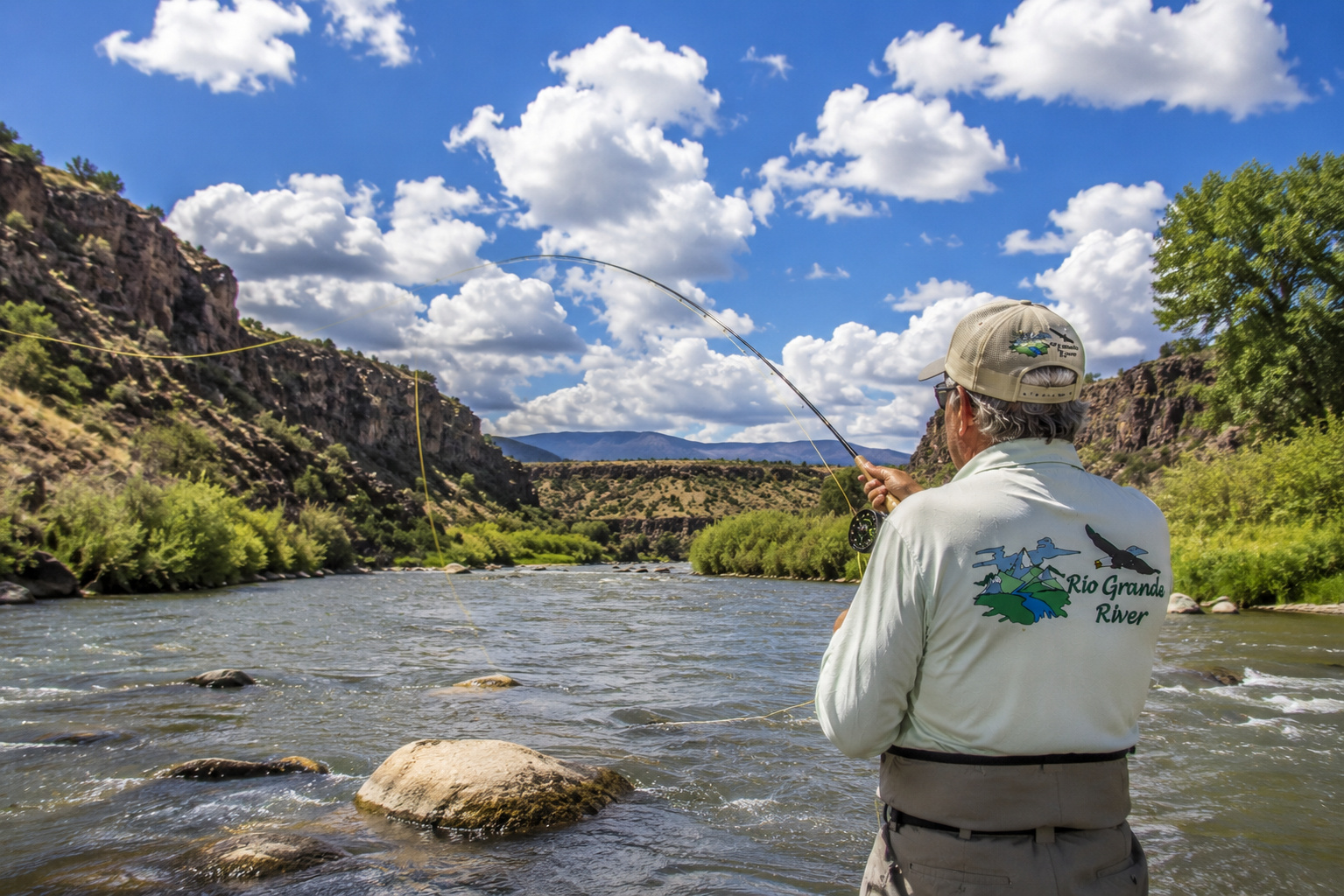
Fly Rods
A 9-foot 5-weight fly rod remains my first choice.
It is difficult to beat for general Rio Grande fishing.
A 4-weight can be delightful during lower flows and dry-fly fishing.
A 6-weight earns its keep when throwing streamers, heavier nymph rigs or fighting wind.
And wind is worth mentioning.
This is the San Luis Valley.
The valley occasionally reminds fly fishermen that hats are detachable.
Fly Reels
Choose a reel that balances the rod and has a smooth drag.
That is really all a trout reel needs to do.
Expensive machinery is enjoyable.
Reliable machinery is essential.
There is a difference.
Fly Line
A weight-forward floating fly line handles most fishing situations.
Carry leaders in several lengths.
For dry flies in clear water, a longer leader may help.
For nymphing, fluorocarbon tippet is useful.
Most everyday fishing can be handled with 3X through 6X tippet.
Adjust to fly size, water clarity and fish.
Dry Flies
Useful patterns include:
Parachute Adams
Elk Hair Caddis
Blue-Winged Olive
Pale Morning Dun
Stimulator
Hopper patterns
Ants
Beetles
During summer, terrestrial fishing can be wonderful.
A grasshopper blown from a bank does not remain a grasshopper very long when a hungry brown trout is underneath.
Nymphs
If I had to choose only a handful, I would carry:
Pheasant Tail
Gold-Ribbed Hare's Ear
Prince Nymph
Copper John
Zebra Midge
Stonefly nymphs
Caddis larvae
Perdigon-style nymphs
The exact pattern often matters less than presentation.
Get the fly down.
Control drag.
Put it where the trout feeds.
That solves a surprising number of fishing problems.
Streamers
For larger brown trout, I like Woolly Buggers, leech patterns and small baitfish imitations.
Fish them around:
undercut banks,
deep bends,
structure,
drop-offs,
and darker water.
Low light helps.
Cloud cover helps.
A little stain in the river can help.
Big browns are predators.
Sometimes it pays to stop treating them like delicate insect collectors.
Productive Trout Water Temperatures
I like trout water roughly in the mid-40s through upper 50s Fahrenheit.
As water temperatures rise through the 60s, I begin paying close attention.
At around 68°F, catch-and-release mortality becomes a serious concern.
During summer, I carry a stream thermometer.
If the water becomes too warm, I stop trout fishing.
Simple as that.
The trout was there before I arrived.
With a little care, perhaps he will be there when I return.
Best Time of Day to Fish
During summer, early morning is my favorite.
Water temperatures are coolest.
Wind may be lighter.
Trout often feed actively.
Evening can also be excellent.
In spring and autumn, midday fishing may become productive as sunlight warms cold water.
Watch insects.
Watch rises.
Watch birds.
Swallows feeding over the river can tell you something is hatching before you ever inspect the water.
Barbless Hooks
I strongly recommend barbless hooks for trout you intend to release.
Pinch the barb with forceps.
It takes seconds.
Hook removal becomes faster.
Handling time decreases.
Damage is reduced.
And should you eventually stick the hook into yourself, which fishermen have been known to accomplish with remarkable creativity, you will be grateful.
Wet Hands Protect Trout
Always wet your hands before touching a trout.
A trout's slime coating helps protect it against disease and infection.
Dry hands can remove that protection.
Never lay a trout on dirt, gravel, dry grass or a sun-heated rock.
The photograph is not worth injuring the fish.
Keep the Trout Fully Submerged
I try to keep a released trout fully submerged throughout most of the process.
That is where a rubber landing net becomes invaluable.
Land the fish.
Keep the net in the river.
Remove the hook while the trout remains underwater whenever possible.
If taking a photograph, prepare everything first.
Lift briefly.
Photograph.
Back into the water.
The fish should spend seconds in the air, not minutes.
Using a Rubber Net and Reviving Trout
Rubber nets are easier on fins and protective slime than traditional abrasive mesh.
Once the hook is removed, I support the trout gently upright in clean current.
I do not squeeze it.
I do not move it violently backward and forward.
I simply let fresh water pass naturally through its gills.
Soon the fish begins holding itself upright.
Then its tail starts working.
Eventually it pushes against my hand.
That is when I let go.
Few moments in fishing are better than watching a healthy trout vanish into clear water.
Public Access
Public access becomes increasingly important as the river crosses agricultural portions of the San Luis Valley.
Some reaches are accessible through public lands and designated recreation areas.
Other river frontage is private.
Colorado law and access conditions require anglers to know where they are.
Do not cross private land simply because you can see the river.
Do not climb fences.
Do not park in front of gates.
Use established public access.
One of the useful upstream examples is the Rio Grande River public fishing access at Coller State Wildlife Area, where anglers can experience the river within established public-access rules.
Respectful fishermen help preserve access.
Careless ones help close it.
Boating the Rio Grande
Floating becomes increasingly practical as the river broadens.
Rafts, drift boats, kayaks and other suitable craft can be used on appropriate sections depending upon flow and legal access.
But water level matters enormously.
High runoff means fast, cold water.
Low summer flows expose rocks and shallow riffles.
Wind can become significant once the river enters the open valley.
Anyone floating unfamiliar water should research:
launch access,
take-out access,
private-property boundaries,
flow,
hazards,
weather,
and current regulations.
Wear a personal flotation device.
Cold water does not care how well you swim.
Camping
Camping opportunities are plentiful around South Fork and within the surrounding Rio Grande National Forest.
As you travel farther east into the agricultural valley, developed forest camping becomes less common immediately beside the river.
But excellent camping opportunities remain in surrounding public lands and mountain areas.
One of the pleasures of this region is using a mountain campground as a base and exploring the valley during the day.
For additional upstream camping ideas, my Rio Grande River headwaters and camping country article explores the higher San Juan Mountain portion of the watershed.
Monte Vista National Wildlife Refuge
One of the finest wildlife stops in the valley is Monte Vista National Wildlife Refuge.
This is wetland country.
And wetland country means birds.
Sandhill cranes are among the celebrities.
During migration, thousands of cranes use the San Luis Valley.
Waterfowl gather here.
Raptors hunt the surrounding fields.
Shorebirds work shallow water.
For a wildlife photographer, this can turn a fishing trip into an entirely different adventure.
I have learned never to leave binoculars or a camera behind simply because the day's official purpose is fishing.
Wildlife rarely consults your itinerary.
Alamosa National Wildlife Refuge
Near Alamosa, the Alamosa National Wildlife Refuge protects additional wetland and riparian habitat associated with the Rio Grande.
Cottonwoods line portions of the river.
Wet meadows provide habitat for birds.
The contrast between water and surrounding high-desert landscape is striking.
The refuge reminds us that the Rio Grande is more than water flowing toward New Mexico.
It is a biological highway.
Great Sand Dunes National Park and Preserve
East of the valley lies one of America's strangest and most beautiful landscapes.
Great Sand Dunes National Park and Preserve contains the tallest dunes in North America, piled against the Sangre de Cristo Mountains.
Sand.
Snow-covered peaks.
Wetlands.
Grasslands.
Forest.
All within one enormous landscape.
The dunes are not directly on the Rio Grande, but they belong to the greater San Luis Valley story.
For anyone traveling this section of river, they deserve a side trip.
San Luis and the Stations of the Cross
At San Luis, one of the most distinctive landmarks is the Stations of the Cross Shrine, overlooking the community from a mesa.
The town's Hispano heritage is visible everywhere.
San Luis also provides access to the remarkable Culebra Range, including Culebra Peak country.
The surrounding landscape carries traditions extending directly south into northern New Mexico.
Anyone familiar with Taos County and the Sangre de Cristo villages will recognize the cultural continuity immediately.
State boundaries came later.
Culture followed valleys and water.
Wildlife Along This Section
The river corridor and surrounding valley support an extraordinary range of wildlife.
Look for:
elk
mule deer
pronghorn
coyotes
beaver
black bears near mountain country
bald eagles
golden eagles
ospreys
sandhill cranes
Canada geese
ducks
hawks
owls
and numerous smaller birds and mammals.
Elk may appear along meadow edges near mountain foothills.
Pronghorn are better adapted to the open valley.
Beaver shape river habitat.
Eagles patrol from cottonwoods.
And during crane season, the sky itself can seem alive.
Weather Through the Seasons
Spring
Spring can be cold, windy and unpredictable.
Snow remains in the mountains.
Runoff begins increasing.
Warm afternoons can alternate with freezing nights.
Summer
Summer days are generally pleasant at this elevation, but the sun is intense.
Afternoon thunderstorms can develop rapidly.
Lightning is a serious hazard in open country.
Carry rain gear.
Autumn
Autumn may be the finest season.
Cool mornings.
Golden cottonwoods.
Yellow aspens in surrounding mountains.
Active trout.
Migrating wildlife.
Clear skies.
It is hard to improve upon.
Winter
Winter in the San Luis Valley is serious business.
Temperatures can fall far below zero.
Snow covers the mountains.
Cold air settles onto the valley floor.
Beautiful?
Absolutely.
Forgiving?
Not particularly.
Getting There
From South Fork, follow U.S. Highway 160 east toward Del Norte.
Highway 160 continues through the San Luis Valley toward Monte Vista and Alamosa.
To reach San Luis, continue through the valley and use the appropriate southbound routes toward Costilla County, including Colorado Highway 159 into San Luis.
The drive itself is part of the experience.
Do not rush it.
Stop in Del Norte.
Explore Monte Vista.
Spend time around Alamosa.
Visit the wildlife refuges.
Look east toward the Great Sand Dunes.
Look west toward the San Juans.
Then head south toward San Luis and watch the Sangre de Cristo Mountains grow larger.
From Mountain River to Valley River
This section of the Rio Grande River teaches an important lesson.
Rivers change because landscapes change.
Above Creede, the Rio Grande is a young mountain stream.
Between Creede and South Fork, it grows through canyon country.
Below South Fork, it steps onto a much larger stage.
The San Luis Valley gives the river room.
It begins meandering.
Agriculture becomes more important.
Wildlife habitat changes.
Water management becomes increasingly visible.
Tributaries gather.
Human history becomes deeper and more complicated.
The Rio Grande is growing up.
An Evening on the Rio Grande
If I could choose my final hour on this stretch, it would be an autumn evening.
The day's wind has settled.
Cottonwoods along the river have turned gold.
Snow dusts the upper Sangre de Cristo peaks.
Somewhere across the valley, sandhill cranes are calling.
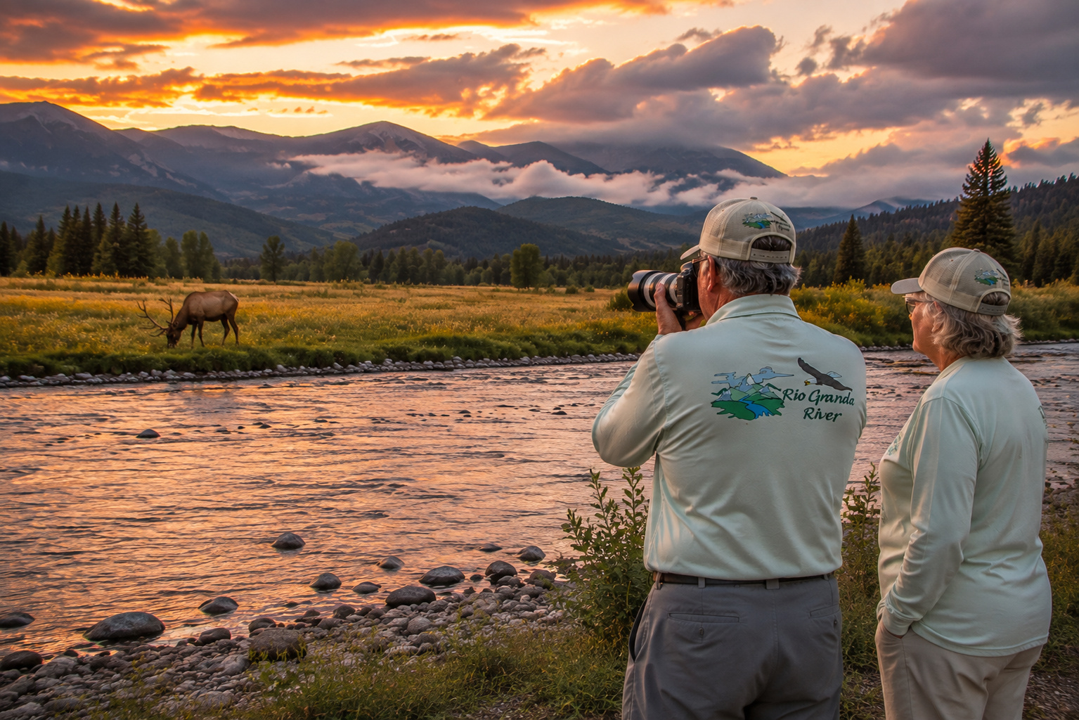
Paulette and I stand near the river with cameras.
A bull elk steps from the cottonwoods into a meadow.
I lift the camera.
He lowers his head to graze.
Behind him, scattered clouds hang over the mountains.
The Rio Grande catches the last sunlight and carries it downstream in broken ribbons of gold.
For a few minutes nobody says anything.
There isn't anything that needs saying.
Eventually the elk disappears.
The light fades.
The mountains turn blue.
And the Rio Grande keeps moving south.
Toward the Conejos.
Toward New Mexico.
Toward Española and Santa Fe country.
Toward Albuquerque.
Toward Elephant Butte.
Toward Texas.
Toward the sea.
I lower the camera.
Paulette and I start back toward the truck.
At eighty-plus years old, I have discovered that the finest outdoor memories are rarely the ones you can schedule.
Sometimes you simply have to be there when the light is right.
And along the Rio Grande River, there are an awful lot of places worth being.
One bend at a time.
One valley at a time.
One sunset at a time.
And our journey downstream is only beginning.
0 Comments