
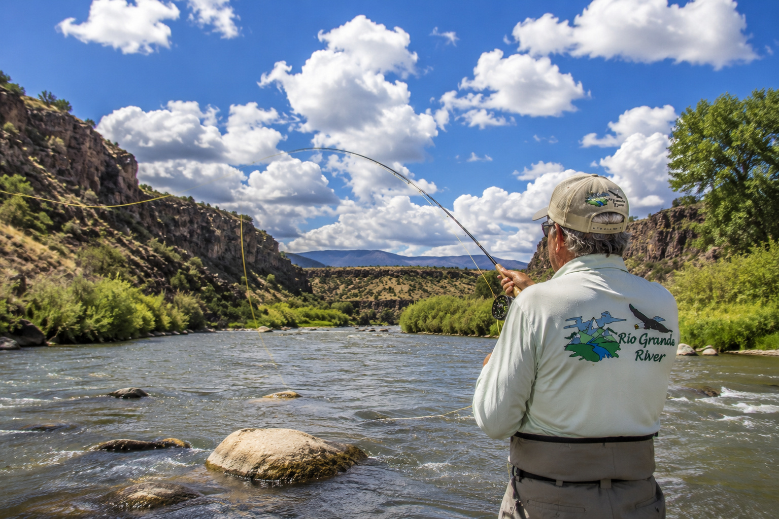
Rio Grande River San Luis Colorado to Taos New Mexico: Into the Great Gorge
There are places along a river where the landscape changes gradually.
Then there are places where the earth seems to split open.
Following the Rio Grande River from the San Luis Valley of southern Colorado into northern New Mexico and on toward Taos gives us both.
We begin in the broad, high country around San Luis, Colorado, where the sky seems large enough to swallow the entire valley. The Sangre de Cristo Mountains rise to the east, the San Juan Mountains stand far to the west, and between them the Rio Grande moves south across country that has supported wildlife and human beings for thousands of years.
Then the river crosses into New Mexico.
And the ground begins disappearing beneath it.
The Rio Grande enters the volcanic country of the Taos Plateau, cuts increasingly deeply through ancient basalt and eventually lies hundreds of feet beneath the surrounding plain.
What had been a river winding across an open valley becomes a river hidden inside a canyon.
This is the country of the Río Grande del Norte National Monument, Wild Rivers Recreation Area, the confluence with the Red River, the Rio Grande Gorge, the famous Rio Grande Gorge Bridge, the Taos Box, bighorn sheep, trout, whitewater and some of the grandest scenery in northern New Mexico.
I know this country well enough to have developed a fondness for its moods.
Paulette and I spent seventeen wonderful years at our mountain home in Angel Fire, looking across the Moreno Valley toward Wheeler Peak, Bobcat Pass and Eagle Nest Lake. Taos was never some distant dot on a map. It was part of our neighborhood, part of the mountain country we explored with cameras, fishing rods and a desire to see what was around the next bend.
These days we spend our summers in Santa Fe, but northern New Mexico still has a way of calling me back.
So let us pick up the Rio Grande River where we left it in southern Colorado and follow it into New Mexico.
We are about to enter the gorge.
From San Luis Colorado Toward the New Mexico Line
There is an important geographical distinction to make at the beginning.
The historic town of San Luis, Colorado, founded in 1851, lies east of the main stem of the Rio Grande along Culebra Creek. The river itself runs west of town through the southern San Luis Valley.
That does not make San Luis irrelevant to our journey.
Quite the opposite.
Culebra Creek, the acequia traditions of the San Luis area, and the old Hispano settlements of Costilla County all belong to the greater cultural and hydrological world of the Rio Grande.
From the river corridor west of San Luis, the Rio Grande continues south toward the Colorado-New Mexico state line.
The country remains deceptively open.
Sagebrush.
Rabbitbrush.
Grassland.
Volcanic mesas.
Distant mountains.
Cottonwoods where enough water reaches their roots.
You can stand on the plateau and see for miles.
But underneath that apparently simple landscape is complicated geology.
And the Rio Grande has found the crack.
The Rio Grande Rift
To understand the Rio Grande Gorge, we need to understand something called the Rio Grande Rift.
This enormous geological feature extends through New Mexico and into Colorado.
Over millions of years, the Earth's crust stretched and faulted. Basins dropped. Mountains rose relative to the valleys. Volcanoes erupted across parts of the region, particularly around the Taos Plateau.
Lava spread across the landscape.
Then water went to work.
The Rio Grande exploited faults and weaknesses, gradually cutting downward through layers of basalt.
The result is the gorge we see today.
The river did not simply carve a canyon into an ordinary plateau.
It carved through a landscape already shaped by tectonic forces and volcanism.
That makes the Rio Grande Gorge more than pretty scenery.
It is a geology lesson with a river running through the middle of it.
Entering New Mexico
As the Rio Grande crosses from Colorado into New Mexico, it enters some wonderfully lonely country.
The San Luis Valley becomes the Taos Plateau.
Ute Mountain rises prominently west of the river.
To the east stand the Sangre de Cristo Mountains and the high peaks around Questa, Latir and Wheeler Peak.
The river begins dropping more deeply into the landscape.
Road access becomes less direct.
Fishing becomes more adventurous.
And soon we arrive at one of my favorite places in northern New Mexico.
Río Grande del Norte National Monument
The Río Grande del Norte National Monument protects an extraordinary portion of northern New Mexico's high desert, volcanic landscape and river corridor.
The monument contains opportunities for hiking, camping, fishing, whitewater rafting, mountain biking, horseback riding, wildlife watching, photography and stargazing.
But the Rio Grande is its spine.
From the plateau rim, the river can appear astonishingly small.
You look down hundreds of feet and see a ribbon of water twisting through black and brown volcanic walls.
Then you hike down to the bottom.
Suddenly that little ribbon becomes a powerful river.
Perspective has a sense of humor.
Wild Rivers Recreation Area
At the northern end of the monument lies the Wild Rivers Recreation Area, near Questa.
I have always thought the name fits.
This is rugged country.
The BLM describes the canyon here as reaching roughly 800 feet deep, cut through volcanic flows by the Rio Grande and Red River.
Wild Rivers provides developed overlooks, campgrounds, trails, picnic areas and access to primitive campsites down inside the gorge.
The most famous viewpoint is La Junta Point.
"La junta" means "the joining."
And that is precisely what happens below.
The Red River joins the Rio Grande.
It is one of the great river views in New Mexico.
I have explored this country in more detail in my article about New Mexico camping and hiking at Wild Rivers Recreation Area, and it remains one of those places where I can happily spend an afternoon doing little more than watching light move across canyon walls.
The Red River Joins the Rio Grande
The Red River is one of the important tributaries in this section.
It begins high in the Sangre de Cristo Mountains around the Red River area, gathering snowmelt and mountain runoff before descending west toward the Rio Grande.
At Wild Rivers the two streams meet at the bottom of the canyon.
That confluence matters to trout.
Tributaries can bring:
colder water,
food,
sediment,
aquatic insects,
spawning opportunities,
and changes in current.
A confluence creates seams.
And fishermen should love seams.
Trout certainly do.
Other Feeder Tributaries
Moving downstream toward Taos, several tributaries influence the Rio Grande.
Among the important streams are:
Red River
Rio Hondo
Rio Pueblo de Taos
and numerous smaller springs, arroyos and seasonal drainages.
The Rio Pueblo de Taos is particularly interesting because it drains mountain country associated with Taos Pueblo before joining the Rio Grande.
I have previously explored the confluence area in Rio Grande River at Rio Pueblo de Taos.
Every tributary changes the river a little.
That is how a great river is built.
One creek at a time.
Ancient Man and the Rio Grande Gorge
People have known this country far longer than we have.
Archaeological evidence throughout the monument and recreation areas demonstrates human use extending back many centuries.
Petroglyphs and archaeological sites remain scattered through portions of the gorge country.
The Rio Grande provided water.
The canyon offered shelter.
Game animals traveled through the corridor.
Plants grew where water supported them.
Trails followed natural routes.
Long before we arrived carrying graphite fly rods and digital cameras, Indigenous peoples understood the value of this river.
The ancestors of today's Pueblo peoples developed deep relationships with the Rio Grande watershed.
Taos Pueblo, east of the gorge, represents one of the oldest continuously inhabited communities in North America.
The river and its tributaries were not scenery to those earlier inhabitants.
They were life.
That is worth remembering whenever we describe public land as "our" playground.
We are very recent visitors.
Lakes Fed by the Rio Grande
This particular stretch of the Rio Grande is primarily river and gorge country rather than reservoir country.
There are no major main-stem reservoirs between the Colorado line and Taos.
That is part of what makes it special.
The river runs free through the gorge.
Farther upstream in Colorado, Rio Grande Reservoir regulates water near the headwaters.
Far downstream in New Mexico, the Rio Grande eventually contributes to major reservoirs such as Cochiti and Elephant Butte.
But here, between southern Colorado and Taos, the river is defined largely by current rather than impoundment.
Nearby mountain lakes and reservoirs occur within the greater watershed, but they should not be confused with lakes directly fed by the main stem.
This section belongs to moving water.
Water Levels and the Personality of the River
Water level changes everything.
The Rio Grande in May can be a completely different creature from the Rio Grande in September.
Spring snowmelt from Colorado and northern New Mexico pushes flows upward.
Tributaries swell.
The river darkens.
Current strengthens.
Wading becomes difficult or dangerous.
Whitewater improves.
Fishing can become challenging.
By late summer and early autumn, flows often decline and clarity improves.
Monsoon thunderstorms can temporarily reverse that trend.
A heavy storm miles upstream may muddy a tributary and turn clear river water brown.
That is why I check current flow information before every serious fishing or boating trip.
Never judge a river by last year's photograph.
Trout of the Rio Grande Gorge
The New Mexico Department of Wildlife identifies several cold-water species within the state's trout fisheries, and the Rio Grande Gorge is known particularly for brown trout and rainbow trout, with Rio Grande cutthroat associated with suitable waters in the broader watershed.
The BLM also identifies northern pike among fish encountered in the Wild Rivers section.
Brown trout are the fish I associate most strongly with the gorge.
They suit the place.
Dark backs.
Golden sides.
Red and black spots.
A tendency to lurk beneath rocks and banks as though they have something to hide.
A big gorge brown can be a formidable fish.
New Mexico Fishing Regulations
New Mexico fishing regulations deserve careful attention because portions of the Rio Grande are designated Special Trout Water.
The New Mexico Department of Wildlife uses Red Chile, Green Chile and Xmas Chile designations for Special Trout Waters.
Some require artificial flies or lures and a single barbless hook.
Some are catch-and-release.
Others allow limited harvest.
The state's current general trout rules list a daily limit of five for brown, brook and rainbow trout in regular waters, while no more than two cutthroat trout may be included, and Special Trout Water rules can differ substantially.
Always check the current regulation for the exact water you intend to fish.
Yesterday's rule is not a fishing license.
My Spinning Rod for the Rio Grande Gorge
There is no requirement that trout fishing involve a fly rod.
Where regulations permit, light spinning tackle can be excellent.
For this water I like a 6½- to 7-foot light-action spinning rod.
Pair it with a 1000- to 2500-size spinning reel.
A smooth drag matters.
The gorge contains rocks, current and trout perfectly capable of making an angler regret cheap equipment.
Spinning Line
I like:
4- to 6-pound monofilament
or
4- to 6-pound fluorocarbon.
Thin braid with a fluorocarbon leader is another useful arrangement.
Clear water favors lighter line.
Higher or stained water permits heavier leaders.
Spinning Bait
Natural bait can catch trout effectively where it is legal.
Worms are difficult to improve upon.
But Special Trout Water restrictions may prohibit bait entirely.
Check before fishing.
Never assume.
Spinning Lures
My gorge spinning box would include:
1/16- to 1/4-ounce inline spinners
small spoons
small minnow plugs
1/32- to 1/8-ounce jigs
small trout-sized soft plastics
Silver and gold remain reliable.
Black creates an excellent silhouette.
Olive, brown and natural baitfish patterns work well in clear water.
Cast across or slightly upstream.
Let the current sweep the lure through seams and pockets.
Do not fight the river.
Use it.
Fly Rods
A 9-foot 5-weight fly rod is nearly ideal for general Rio Grande Gorge trout fishing.
For larger streamers or heavier nymph rigs, I might use a 6-weight.
For delicate dry-fly fishing under low-water conditions, a 4-weight can be delightful.
The gorge can also be windy.
That is worth remembering when choosing tackle.
A perfect little 3-weight is less charming when a canyon wind starts rearranging your fly line.
Fly Reels and Fly Line
A quality reel with a smooth drag is sufficient.
I prefer a weight-forward floating fly line for most fishing.
Add leaders of different lengths and tippet ranging generally from 3X through 6X.
Fluorocarbon is particularly useful for nymphing.
Dry Flies
The Rio Grande can produce excellent dry-fly fishing when conditions cooperate.
I carry:
Elk Hair Caddis
Parachute Adams
Blue-Winged Olive
Stimulators
Pale Morning Duns
Stonefly patterns
Hoppers
Ants
Beetles
Caddis can be particularly important.
During the right spring conditions, caddis activity can transform the river.
Terrestrials become increasingly useful during summer.
Nymphs
If trout are not looking up, go down.
My basic nymph selection includes:
Pheasant Tail
Gold-Ribbed Hare's Ear
Prince Nymph
Copper John
Zebra Midge
Stonefly nymphs
Caddis larvae
Perdigon-style nymphs
Depth matters.
A nymph floating two feet above a trout's feeding lane may be beautifully tied and completely useless.
Streamers
For larger browns, I like:
Woolly Buggers
leech patterns
small sculpin patterns
and
baitfish streamers.
Fish them near structure.
Deep pools.
Undercut banks.
Boulders.
Dark water.
Cloudy days can be excellent.
So can early morning and evening.
Productive Water Temperatures
Trout generally thrive in cold water, and I consider temperatures from roughly the mid-40s through upper 50s Fahrenheit excellent fishing territory.
Once temperatures climb into the mid and upper 60s, I begin paying attention.
At around 68°F, I become very reluctant to continue catch-and-release trout fishing.
Warm water contains less dissolved oxygen.
A trout that swims away after a long fight may still die later.
Carry a thermometer.
If the river becomes too warm, put the rod away.
The gorge will still be there.
Best Time of Day
During summer, early morning is my first choice.
The water is coolest.
Wind may be lighter.
Trout are less stressed.
Evening can also be excellent.
Spring and autumn may offer good fishing throughout more of the day.
Watch the river rather than the clock.
Insects tell you things.
Birds tell you things.
Rising trout are particularly eloquent.
Barbless Hooks
I strongly favor barbless hooks for trout I intend to release.
In some Special Trout Waters they are required.
Even where they are not, I use them voluntarily.
A barbless hook usually comes out quickly.
That means less handling.
Less damage.
And a faster return to the river.
Wet Your Hands
Before touching a trout, wet your hands.
That protective slime coating is part of the fish's defense against infection.
Dry hands can remove it.
Do not lay trout on rocks.
Do not put them on dry grass.
Do not hold them in the air while everybody in the group takes a photograph.
We can do better than that.
Keep Trout Fully Submerged
I keep a released trout fully submerged whenever possible.
That begins with a rubber landing net.
Slide the trout into the net.
Keep the net in the river.
Remove the barbless hook while the fish remains underwater if possible.
If I want a photograph, I get everything ready first.
Lift.
Photograph.
Back into the water.
Seconds.
Not minutes.
Using a Rubber Net to Revive Trout
A rubber net is easier on fins and protective slime than traditional abrasive mesh.
Once the hook is removed, I support the trout gently in clean current.
Face the fish upstream.
Let water move naturally through its gills.
Do not pump it violently backward and forward.
Soon the fish begins holding itself upright.
Then comes that little kick of the tail.
That is the moment I enjoy.
Open your hands.
Let him go.
Whitewater Rafting the Rio Grande
Now we come to an entirely different way of meeting the river.
Whitewater.
The Rio Grande Gorge contains some of the finest rafting in New Mexico.
The BLM divides the upper gorge into several sections.
The Ute Mountain Run is Class II.
The Upper Box reaches Class V.
The famous Taos Box runs about 15 miles and contains Class III-V whitewater.
The BLM specifically warns that the Taos Box requires expert boating skills and prior familiarity with the route.
That warning should be taken seriously.
This is not a theme-park ride.
Cold water, canyon walls, rocks and powerful hydraulics do not negotiate.
The Taos Box
The Taos Box is legendary among Western rafters.
The river is confined within deep canyon walls.
Rapids arrive in succession.
Access is limited.
Once committed to the canyon, you cannot simply pull into a parking lot when somebody decides he has had enough.
Commercial outfitters provide guided trips during appropriate flows.
For most visitors, that is the sensible way to experience serious whitewater.
A professional guide knows the river, equipment and rescue procedures.
Pride weighs considerably more than a life jacket.
The Racecourse
Downstream, the Racecourse provides a more accessible whitewater experience.
My earlier article about Rio Grande Gorge whitewater rafting on the Racecourse explores that stretch in greater detail.
Depending upon flows, the Racecourse contains Class II and III rapids and is frequently used for guided rafting trips.
It provides plenty of excitement without requiring the commitment of the Taos Box.
Rio Grande Gorge Bridge
Then there is the bridge.
The Rio Grande Gorge Bridge carries U.S. Highway 64 across the canyon northwest of Taos.
Completed in 1965, the bridge stretches 1,272 feet across the gorge and stands roughly 650 feet above the Rio Grande.
Those numbers sound impressive.
Standing on the bridge is considerably more persuasive.
Look down.
Way down.
The river appears impossibly small.
Cars crossing the bridge feel perfectly normal.
Then you walk toward the rail and discover there is a geological absence beside you.
The bridge received recognition soon after construction as an outstanding long-span steel bridge, and today it remains one of New Mexico's most recognizable landmarks.
For photographers, morning and late afternoon provide beautiful light across the gorge.
Hold onto your hat.
The wind has collected quite a few souvenirs up there.
Wildlife of the Rio Grande Gorge
The gorge is outstanding wildlife habitat.
According to New Mexico wildlife reports, the Rio Grande Gorge supports one of the state's iconic populations of Rocky Mountain bighorn sheep.
The herd was reestablished beginning in the mid-2000s using sheep relocated from the Pecos Wilderness.
Recent state management information estimates the Rio Grande Gorge population at roughly 225 to 275 animals.
They move between the river corridor and canyon rim.
That creates remarkable wildlife-viewing opportunities.
I never tire of seeing bighorn sheep.
An animal standing on a cliff face that I would hesitate to crawl across can walk along it as casually as I cross a kitchen floor.
Other Wildlife
BLM and state wildlife information identifies an impressive variety of animals in the gorge country.
Look for:
Rocky Mountain bighorn sheep
mule deer
elk
beaver
river otter
cougar
ringtail
bats
coyotes
golden eagles
bald eagles
red-tailed hawks
waterfowl
and numerous songbirds.
River otters deserve special mention.
New Mexico reintroduced otters to the upper Rio Grande beginning in 2008 after they had disappeared from the state's rivers decades earlier.
Seeing one today would be a fine reminder that wildlife restoration sometimes works.
Public Access
One of the great advantages of the Río Grande del Norte National Monument is the amount of public recreation access.
But "public" does not mean "effortless."
At Wild Rivers, reaching the river can require steep hikes dropping hundreds of feet into the gorge.
Some trails are strenuous.
Summer heat at river level can surprise people who began their hike in cool air on the rim.
Carry water.
More than you think you need.
BLM currently advises that potable water is unavailable at Wild Rivers campgrounds, so anyone planning a visit should check the latest status and arrive prepared.
Camping at Wild Rivers
Wild Rivers offers several developed campgrounds, including:
El Aguaje
La Junta
Montoso
Little Arsenic
and
Big Arsenic.
There are also primitive campsites within the inner gorge.
Those inner-gorge sites require hiking down and back out.
Remember that every pound carried downhill must eventually come uphill again.
Gravity offers introductory rates.
The return trip costs full price.
Orilla Verde Recreation Area
Farther downstream, Orilla Verde Recreation Area provides easier access to the river.
The river here sits around 6,100 feet elevation while canyon walls rise roughly 800 feet.
The area offers camping, boating, fishing, hiking and wildlife watching.
I have covered the area in my article about Rio Grande Gorge at Taos Junction.
This is a particularly useful place for visitors who want to experience the gorge without undertaking the strenuous descent required at Wild Rivers.
Pilar and the Lower Gorge
Near Pilar, the Rio Grande becomes accessible along NM 68.
This stretch is popular with anglers, rafters, campers and photographers.
My earlier visit to the Rio Grande Gorge at Pilar New Mexico captures the way the river can change after summer monsoon storms.
Clear green water can become chocolate-colored surprisingly quickly when runoff enters from side drainages.
That is another reason to watch weather throughout the watershed.
Weather Through the Seasons
Spring
Spring means rising water.
Snowmelt increases flows.
Fishing conditions can change rapidly.
Whitewater season begins becoming interesting.
Days may be pleasant while nights remain cold.
Summer
Summer brings warm days, cool mornings and afternoon thunderstorms.
BLM reports summer temperatures at Wild Rivers ranging roughly from the mid-40s to around 90°F.
July and August thunderstorms are common.
A thunderstorm over distant mountains can create runoff in a canyon drainage even when the sky above you looks harmless.
Never camp in a drainage.
Autumn
Autumn may be my favorite season.
Cool mornings.
Lower flows.
Clearer water.
Active brown trout.
Golden cottonwoods.
Fewer visitors.
Bighorn sheep moving through canyon country.
For photography and fishing, September and October can be wonderful.
Winter
Winter is beautiful but serious.
Snow is possible from November through March.
BLM notes winter temperatures at Wild Rivers can range from around -15°F to 45°F.
Roads and trails may become icy.
The canyon receives limited winter sunlight in places.
Go prepared.
Taos New Mexico
Eventually our journey brings us to Taos.
Few towns in the Southwest have accumulated more layers of identity.
Pueblo history.
Spanish settlement.
Hispano culture.
Ranching.
Art.
Skiing.
Counterculture.
Tourism.
And beneath all of it, an extraordinary landscape.
Taos sits east of the Rio Grande Gorge beneath the Sangre de Cristo Mountains.
Taos Pueblo lies nearby.
Wheeler Peak rises beyond.
The Rio Grande cuts through the plateau to the west.
For Paulette and me, after seventeen years living across the mountains in Angel Fire, Taos always felt familiar.
It is one of those towns where you can spend the morning photographing adobe walls, eat green chile for lunch, fish the Rio Grande in the afternoon and watch alpenglow spread across the mountains before supper.
That is a pretty respectable day.
Points of Interest Along This Stretch
Traveling from southern Colorado to Taos, I would make time for several places.
San Luis, Colorado, for its history and Hispano culture.
The Colorado-New Mexico border country for its broad landscapes.
Ute Mountain, standing alone above the plateau.
Wild Rivers Recreation Area and La Junta Point.
The Red River-Rio Grande confluence.
The Río Grande del Norte National Monument.
The Rio Grande Gorge Bridge.
The Taos Box.
Orilla Verde Recreation Area.
Pilar.
Taos Pueblo, respecting tribal rules and closures.
Historic Taos Plaza.
And the mountain country east of town.
Do not try to see everything through a windshield.
Get out.
Walk.
Listen.
Getting There
From San Luis, Colorado, travel south toward the New Mexico border using the highway network through Costilla County and toward Questa.
NM 522 becomes the principal north-south route into the Questa and Taos country.
For Wild Rivers, travel north from Questa on NM 522 and turn west onto NM 378.
The Wild Rivers Backcountry Byway forms a roughly 13-mile paved loop through the recreation area.
For the Rio Grande Gorge Bridge, take U.S. Highway 64 west from Taos.
For Orilla Verde and Pilar, NM 68 follows the river corridor south of Taos.
Distances are not enormous.
But allow time.
This is not country meant to be rushed.
The River Disappears
Perhaps the strangest thing about this portion of the Rio Grande is how completely the river can vanish from sight.
On the San Luis Valley floor, water is part of the visible landscape.
Then the river crosses onto the Taos Plateau and begins cutting downward.
Soon you can drive across miles of open sagebrush without seeing it at all.
You know the Rio Grande is there.
Somewhere.
Then you reach an overlook.
The ground falls away.
And hundreds of feet below, there it is.
Still moving south.
An Evening Above the Gorge
I can imagine a perfect evening near Taos.
Paulette and I have spent the day wandering the river country with cameras.
The afternoon thunderstorms have moved east toward the Sangre de Cristo Mountains.
Clouds still cling around the peaks.
Sunlight comes beneath them.
The gorge turns gold.
Far below, the Rio Grande catches pieces of sky.
A bighorn ram appears on a rocky shelf.
I raise the camera.
He stands perfectly still.
For once, so do I.
Behind us lies Colorado.
Ahead lies Española, Santa Fe, Albuquerque and another thousand miles of river.
The old ram eventually disappears behind the basalt.
The sun sinks lower.
A raven crosses the gorge.
And somewhere far below, water moves over stone.
At eighty-plus years old, I find myself increasingly grateful for moments that require nothing from me except attention.
Growing up in the Kansas Flint Hills taught me to respect land and water.
Living with Paulette in the mountains at Angel Fire taught me how quickly seventeen years can pass.
Photography taught me to notice light.
Fishing taught me patience.
And the Rio Grande keeps reminding me that everything moves downstream eventually.
So I stand at the edge of the gorge a little longer.
No hurry.
Tomorrow we can follow the Rio Grande River farther south.
Tonight, Taos is enough.
0 Comments