
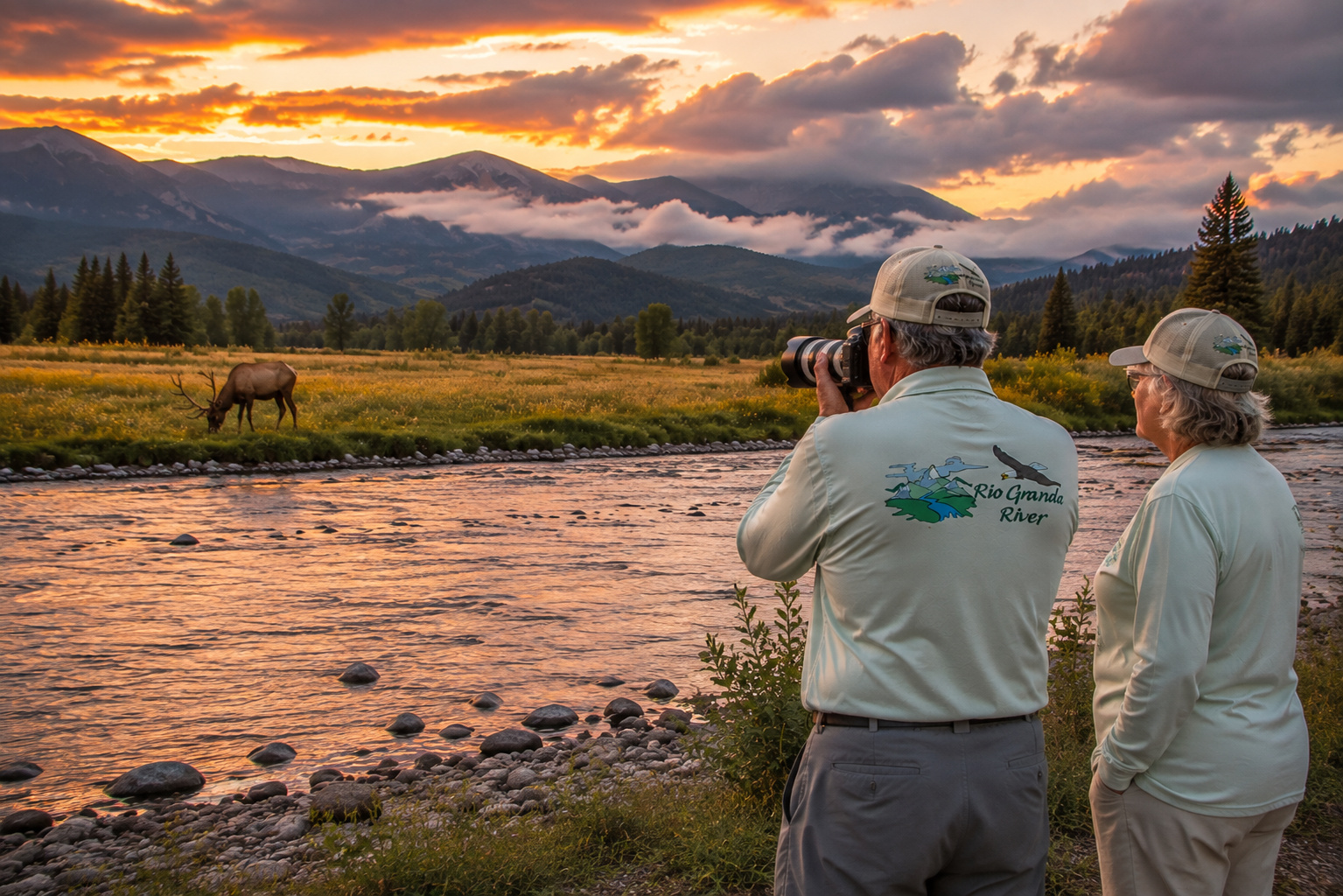
The Rio Grande River between Creede and South Fork, Colorado, is one of them.
You can cover the highway miles without much trouble, but that would rather defeat the purpose. This is country where I want to pull over, walk down to the water, watch a fly fisherman working a run, photograph sunlight on a cliff and perhaps sit on a boulder for a while without accomplishing anything measurable.
At eighty-plus years old, I have become increasingly suspicious of vacations that require a stopwatch.
I grew up on cattle ranches in the Kansas Flint Hills, where the rhythms of life were established by weather, livestock, grass and water rather than a wristwatch. Those early years gave me a respect for rivers and streams that has followed me throughout my life.
Many decades later, Paulette and I built our log home high in the mountains at Angel Fire, New Mexico. We spent seventeen wonderful years overlooking the Moreno Valley, surrounded by mountains, forests, wildlife and water. Photography, videography, fishing and plain old curiosity have kept me wandering through the Southwest ever since.
And one of the places I return to, at least in memory when I cannot be there in person, is the upper Rio Grande River in Colorado.
In my previous article I followed the river from its mountain headwaters through Rio Grande Reservoir to Creede.
Now we will pick it up at Creede and follow it downstream toward South Fork.
This is where the Rio Grande begins growing up.
It is still a mountain river, still cold enough for trout and still surrounded by the San Juan Mountains. But below Creede it gathers tributaries, cuts through spectacular rock formations, passes historic Wagon Wheel Gap, winds through public fishing water and finally reaches South Fork, where the character of the valley begins changing again.
For an outdoorsman, photographer or trout fisherman, it is a wonderful piece of river country.
The Rio Grande River Leaves Creede
Creede sits at roughly 8,800 feet in the San Juan Mountains.
The river arriving here has already traveled from its high-country beginnings, passed through Rio Grande Reservoir, collected water from mountain tributaries and worked its way through some beautifully remote country.
Rio Grande Reservoir remains enormously important to everything downstream. Its releases influence flows below the dam, while the reservoir itself provides trout fishing and boating opportunities in spectacular high-elevation surroundings.
I explored that country more closely in my article about Rio Grande Reservoir fly fishing near Creede Colorado.
Once the Rio Grande reaches Creede, it begins a fascinating transition.
The valley narrows.
Cliffs appear.
Tributaries continue feeding the river.
Highway 149 follows much of the corridor.
And for a fisherman, the river starts looking better every mile.
Creede: Where Mining History Meets Trout Water
Creede is worth a visit even if you never make a cast.
The town grew from Colorado's silver-mining era, and unlike some Western communities that have polished away nearly every rough edge, Creede still carries visible traces of its mining past.
The surrounding geology explains why.
This is volcanic country, shaped by enormous ancient eruptions and later erosion. Mineral-rich formations eventually attracted prospectors and miners, while the Rio Grande carved its own route through the mountains.
Creede today mixes that history with restaurants, shops, galleries, lodging and outdoor recreation.
I enjoy communities where you can spend the morning trout fishing and the afternoon studying the machinery that once pulled ore out of a mountain.
Creede manages that combination rather nicely.
For a closer look at the town itself, my Creede Colorado visit provides a good companion to this river journey.
Geography Between Creede and South Fork
The drive from Creede to South Fork follows Colorado Highway 149 for roughly 20 miles through a corridor that continually changes personality.
Around Creede, steep volcanic formations crowd the valley.
Moving downstream, the Rio Grande works through alternating stretches of meadow, forest and canyon.
Cottonwoods and willows line portions of the river.
Ponderosa pine, Douglas fir, spruce and aspen occupy surrounding slopes depending upon elevation and exposure.
The river itself alternates between pools, riffles, boulder gardens, undercut banks and long runs.
Those differences are not merely scenic.
They create trout habitat.
A trout needs places to feed, hide and conserve energy. The complicated structure of the Rio Grande between Creede and South Fork provides plenty of all three.
Feeder Tributaries: Building a Bigger Rio Grande
By the time the river leaves Creede, numerous upstream tributaries have already contributed to its flow.
Around Creede, Willow Creek enters the Rio Grande after draining mountain country immediately north of town.
Farther downstream, smaller creeks, springs and seasonal drainages continue adding water.
Near South Fork comes one of the important geographical moments of the journey: the South Fork of the Rio Grande joins the main river.
That confluence helped give the town its name.
The South Fork originates in the Wolf Creek Pass country and parallels portions of Highway 160 before joining the Rio Grande.
A tributary does much more than increase the number on a stream gauge.
It can introduce colder water.
Aquatic insects.
Sediment.
Woody debris.
Nutrients.
Spawning habitat.
And fish.
One of the things I learned growing up around ranch country is that small water matters.
A creek you can step across may influence an entire watershed.
Water Levels: Check Before You Go
The upper Rio Grande is a snowmelt river, and that means water level changes dramatically through the seasons.
Winter snow accumulating in the San Juan Mountains becomes spring and early-summer runoff.
As temperatures climb, snow begins melting and tributaries swell.
The Rio Grande rises.
During heavy runoff, water that was easily wadeable a few weeks earlier can become powerful and dangerous.
By later summer, flows generally decline, although reservoir releases and thunderstorms can alter conditions.
Autumn often brings lower, clearer water.
That seasonal rhythm is why I never rely entirely upon somebody saying, "It fished well last week."
Last week is history.
Before fishing or floating, check current streamflow and local conditions.
Water temperature deserves the same attention.
The river always gets the final vote.
Rio Grande Reservoir and the Lakes of the Watershed
Although Rio Grande Reservoir lies upstream of Creede, it remains an important part of this section's story because releases from the reservoir affect the river below.
The surrounding watershed also contains numerous mountain lakes and reservoirs.
Near the South Fork region, waters such as Beaver Creek Reservoir and Big Meadows Reservoir provide additional fishing and boating opportunities.
Big Meadows is west of South Fork in the San Juan Mountains. The surrounding recreation area provides hiking and fishing, while boats are permitted on the reservoir under no-wake conditions. (Southfork)
The Rio Grande National Forest country surrounding South Fork is sprinkled with additional creeks, lakes and reservoirs, making it possible to spend a week here without fishing the same kind of water twice.
River in the morning.
Mountain lake after lunch.
Small creek before supper.
That sounds like a respectable day's work to me.
Ancient People Along the Upper Rio Grande
Long before miners arrived at Creede and long before anyone paved Highway 149, human beings traveled through the greater Rio Grande watershed.
Indigenous peoples used the San Luis Valley and surrounding mountain passes for thousands of years.
The broader region was associated particularly with Ute peoples, while other Indigenous groups traveled, hunted and traded across the mountains and valleys.
The National Park Service notes that routes through the San Luis Valley such as Mosca and Medano passes had been used by Indigenous travelers for thousands of years before they became wagon roads. (National Park Service)
Water shaped those movements.
Rivers were navigation corridors before roads existed.
They attracted game.
They supported edible and medicinal plants.
They offered fish.
They provided dependable water.
When we look at the Rio Grande today as fishermen or recreationists, it is worth remembering that our relationship with the river is relatively recent.
Human beings were following this water long before Colorado existed on a map.
Trout Fishing the Rio Grande River
Now we get to the subject that can make a grown fisherman forget lunch.
The Rio Grande between Creede and South Fork is excellent trout country.
Brown trout and rainbow trout dominate much of this water.
Colorado Parks and Wildlife describes the river within Coller State Wildlife Area as supporting both species and providing excellent shore, wade and float fishing. CPW notes that the section meets Gold Medal standards for numbers of larger fish, although its estimated biomass falls slightly below the Gold Medal threshold. (Colorado Parks and Wildlife)
That is impressive trout water by any reasonable standard.
Brown trout particularly fascinate me.
They are creatures of structure.
Look beneath undercut banks.
Behind large rocks.
Along submerged logs.
At the tail of pools.
Beside willow roots.
And especially along current seams where fast and slow water meet.
A good brown often occupies a place where food comes to him while he expends very little energy.
Come to think of it, that is not a bad retirement strategy either.
Coller State Wildlife Area
One of the best-known public-access areas along this stretch is Coller State Wildlife Area, above South Fork.
It covers 579 acres, ranging from roughly 8,167 to 9,016 feet in elevation. Fishing, picnicking and wildlife viewing are among the permitted recreational activities. (Colorado Parks and Wildlife)
For anglers, this is particularly valuable because so much Western river frontage is private.
Colorado Parks and Wildlife describes the river here as offering shore, wading and float-fishing opportunities with substantial habitat structure. (Colorado Parks and Wildlife)
I've covered the area separately in my Rio Grande River Coller State Wildlife Area fly fishing and public access article.
One important detail: visitors age 16 and older generally need either a valid Colorado hunting or fishing license or an SWA pass to access Coller SWA. Current site-specific rules should always be checked before visiting. (Colorado Parks and Wildlife)
Current Special Fishing Regulations
The Coller SWA section has important fishing regulations.
Colorado Parks and Wildlife currently specifies:
-
Fishing is restricted to artificial flies and lures.
-
The bag and possession limit for brown trout is two fish, with a maximum size of 12 inches.
-
All rainbow trout must be returned immediately to the water. (Colorado Parks and Wildlife)
Regulations can change, so check the current Colorado fishing regulations before every trip.
Never depend upon an old fishing article, including mine, as your legal authority.
Spinning Rods for Rio Grande Trout
I enjoy fly fishing, but I have never believed trout care what sort of reel you own.
Light spinning tackle can be wonderfully effective where regulations permit.
For the Creede-to-South Fork section, I like a 6- to 7-foot light-action spinning rod.
Pair it with a 1000- to 2500-size spinning reel with a smooth drag.
A 6½-foot light rod is a particularly versatile compromise.
It has enough length for line control and casting but remains comfortable around brush and confined banks.
Spinning Line
My basic choices are simple.
4- to 6-pound monofilament works beautifully.
Fluorocarbon provides additional invisibility and abrasion resistance.
Another excellent arrangement is thin braid with a 4- to 6-pound fluorocarbon leader.
Keep the tackle light.
The Rio Grande is not the place for bass tackle better suited to hauling largemouths out of hydrilla.
Let the rod bend.
Let the drag work.
Enjoy the fish.
Spinning Lures and Baits
Where bait is legal, worms and other permitted trout baits can be productive.
But remember that bait is not legal in artificial-only sections such as the regulated Coller SWA water. (Colorado Parks and Wildlife)
For artificial-lure fishing, I would carry:
-
1/16- to 1/4-ounce inline spinners
-
Small spoons
-
1/32- to 1/8-ounce jigs
-
Small minnow plugs
-
Trout-sized soft plastics
Silver, gold, black, brown and olive are dependable colors.
Bright colors can help in stained water.
Natural colors generally get my vote when the river is clear.
Cast slightly upstream or across current and allow the lure to work naturally through seams and pockets.
Fly Rods and Fly Reels
A 9-foot 5-weight fly rod remains my favorite general-purpose outfit for this river.
It handles dry flies, nymphs and reasonable streamers without being excessive.
If I expect wind, heavy nymph rigs or bigger streamers, I might step up to a 6-weight.
A quality reel should balance the rod and provide a smooth drag.
You do not need the most expensive reel in Colorado.
Trout have never asked me what I paid for mine.
Fly Line, Leaders and Tippet
A weight-forward floating fly line handles the majority of fishing.
For dry flies, I generally prefer a longer nylon leader.
For nymphing, fluorocarbon tippet has advantages because it sinks readily and is difficult for trout to see.
Useful tippet sizes generally range from 3X through 6X, depending upon water conditions, fly size and the size of fish expected.
Low, clear autumn water may demand finer tackle.
Higher spring water allows something sturdier.
Dry Flies
The Creede area has a rich aquatic insect population.
Local fishing information identifies caddis activity from roughly May into September and important summer mayfly and stonefly activity. (Creede)
I would carry:
Elk Hair Caddis
Parachute Adams
Blue-Winged Olives
Green Drake patterns
Stimulators
Pale Morning Dun patterns
Hoppers
Ants
Beetles
A large dry fly with a smaller nymph suspended beneath it can be especially effective during summer.
Nymphs
Trout spend far more time feeding below the surface than above it.
That makes nymphs indispensable.
My box would include:
Pheasant Tail
Gold-Ribbed Hare's Ear
Prince Nymph
Copper John
Zebra Midge
Stonefly nymphs
Caddis larvae and pupae
Girdle Bugs
Local Creede fishing information specifically recommends several of these patterns, including Pheasant Tails, Hare's Ears and stonefly imitations. (Creede)
Getting the nymph to the correct depth is often more important than having the perfect pattern.
A mediocre fly in the feeding lane beats a masterpiece floating two feet over a trout's head.
Streamers for Brown Trout
Do not forget streamers.
Woolly Buggers, leech patterns and small baitfish imitations can tempt larger browns.
Work them around undercut banks, deep runs and structure.
Cloudy days are particularly interesting.
So are early mornings and evenings.
Big brown trout have a predatory streak that becomes much more apparent when the light gets low.
Productive Water Temperatures
Trout fishing is generally productive when water temperatures are roughly in the mid-40s through upper 50s Fahrenheit.
As summer progresses, temperature becomes increasingly important.
Once water temperatures climb into the upper 60s, trout experience greater stress.
Around 68°F, I become very reluctant to continue catch-and-release trout fishing.
Carry a stream thermometer.
It weighs almost nothing.
During hot weather, temperature may be more important than what fly you have tied on.
Best Time of Day to Fish
In spring, the best fishing may occur later in the morning after sunlight warms the river.
Summer favors early mornings and evenings.
Autumn can produce excellent fishing throughout much of the day.
My favorite summer schedule is simple.
Get up early.
Fish the cool morning.
Eat lunch.
Photograph the mountains.
Take a nap if nobody is looking.
Return to the river as evening approaches.
At my age I call that conservation of both trout and fisherman.
Barbless Hooks
I strongly favor barbless hooks for trout I intend to release.
A barbless hook is quicker to remove and generally reduces handling time.
You can buy barbless flies or simply pinch the barb flat with forceps.
It takes seconds.
The fish benefits.
And sooner or later you will put a hook into your own finger and appreciate the decision personally.
Wet Your Hands
Before touching a trout, wet your hands.
Trout are protected by a slime coating that helps defend them from infection.
Dry hands can damage that coating.
Never lay a trout on dry grass, dirt, sand or hot rocks for a photograph.
A trout is not a prop.
Keep Trout Fully Submerged
My preferred release routine is straightforward.
Land the trout in a rubber net.
Leave the net in the river.
Keep the trout fully submerged while removing the hook.
If I want a photograph, I prepare the camera first.
Then I lift the trout only briefly.
Photograph.
Back into the water.
If it needs help recovering, I support it gently upright in cool, clean current so water passes naturally through its gills.
I never pump a trout violently backward and forward.
When the fish maintains its balance and begins pulling away, I loosen my hands.
Off he goes.
That is exactly where I want him.
Rubber Landing Nets
A rubber landing net should be standard equipment for catch-and-release trout fishing.
Rubber mesh reduces damage to fins and slime coating and tangles hooks far less readily than traditional knotted nylon.
It also keeps the fish contained in the water while you prepare for release.
There is very little downside.
Public Fishing Access
Public access is one of the biggest considerations along the upper Rio Grande.
Some river frontage is public.
Some is private.
Never assume that proximity to Highway 149 automatically means public fishing access.
Coller State Wildlife Area provides important established access. Other Forest Service and public-access areas occur along the corridor.
My Rio Grande River fly fishing public access at USFS Road 430A article describes another useful access opportunity in the upper river region. Your site also emphasizes the importance of respecting posted private property. (Rio Grande River)
That is advice worth repeating.
Use established access.
Respect fences.
Close gates.
Do not block ranch roads.
Pack out everything you carry in.
Boating and Floating the Rio Grande
The Rio Grande between Creede and South Fork is also popular with float fishermen, rafters and paddlers when flows permit.
But flow changes everything.
During runoff, the river becomes faster, colder and more powerful.
Later in summer, lower water may expose rocks and make some sections more technical.
At Coller SWA, vessels may be launched or taken out, but vessel use within the property itself is restricted to those circumstances and hand-propelled craft under the site's rules. (Colorado Parks and Wildlife)
Anyone floating unfamiliar water should investigate the route, access, hazards and current flows beforehand.
Wear a properly fitted personal flotation device.
Cold mountain water can disable a swimmer astonishingly quickly.
Camping Between Creede and South Fork
The Rio Grande National Forest offers numerous camping opportunities throughout the region.
The Forest Service reports 33 developed campgrounds with more than 650 individual sites across Rio Grande National Forest, along with dispersed camping opportunities where permitted. (Forest Service)
For this particular stretch, Palisade Campground deserves special mention.
The Forest Service describes it as the only campground directly along the Rio Grande in the canyon between Creede and South Fork. It sits beside Highway 149, making it particularly convenient for fishermen and travelers. (Forest Service)
Remember that this is bear country.
Keep a clean camp.
Store food properly.
Pack out trash.
And check current fire restrictions.
Wagon Wheel Gap
One of my favorite landmarks between Creede and South Fork is Wagon Wheel Gap.
The river squeezes through dramatic volcanic cliffs here, creating one of the signature landscapes of the upper Rio Grande.
The name traditionally comes from the story of an old wagon wheel discovered stuck in the mud.
The gap later became associated with hot springs, tourism and the Denver & Rio Grande Railway.
I explored its history and scenery in my Rio Grande River at Wagon Wheel Gap article.
This is one of those places where geology, transportation history and trout fishing occupy the same few acres.
That combination suits me perfectly.
The Palisades
Downstream toward South Fork, the Palisades rise dramatically above the river.
These cliffs are among the finest photographic subjects along Highway 149.
Morning and late-afternoon light can bring out remarkable texture in the rock.
Your own Rio Grande River material notes that bighorn sheep can be seen along south-facing Palisade cliffs, while golden eagles use the Wagon Wheel Gap area. (Rio Grande River)
I would keep binoculars handy.
A fisherman staring only at his fly may miss half the show.
Wildlife Along the River
The Creede-to-South Fork corridor supports an impressive collection of Rocky Mountain wildlife.
Elk
Mule deer
Moose
Black bears
Bighorn sheep
Coyotes
Beaver
Marmots
Bald eagles
Golden eagles
Ospreys
Waterfowl
And countless smaller creatures live along or depend upon the watershed.
Coller SWA specifically manages habitat for species including elk, deer, grouse, rabbit and squirrel. (Colorado Parks and Wildlife)
The river itself creates a biological corridor through otherwise rugged mountain terrain.
Where there is water, there is life.
That was true on the Kansas ranches of my boyhood and it is just as true in the San Juan Mountains.
South Fork Colorado
Eventually the river reaches South Fork, sitting at the junction of Highway 149 and U.S. Highway 160.
The town occupies an important crossroads.
Highway 149 leads back toward Creede.
Highway 160 heads west toward Wolf Creek Pass and Pagosa Springs or east toward Del Norte and the San Luis Valley.
South Fork has become a natural base for fishing, rafting, hiking, ATV riding, horseback riding, skiing, snowmobiling and exploring the Rio Grande National Forest. The local visitor organization lists everything from guided fishing and horseback trips to rail biking, golf and winter recreation. (Southfork)
The town also provides easy opportunities simply to sit beside the Rio Grande.
Rickel Park lies next to the river and Highway 160, while Brown Memorial Park provides additional river access near Highway 149 and County Road 15. (Southfork)
South Fork feels like a transition point.
Behind you lies the narrower mountain river toward Creede.
Ahead, the Rio Grande begins moving toward the broader San Luis Valley.
Points of Interest Along the Creede-to-South Fork Route
If I were driving this section for photography, fishing and sightseeing, several places would get my attention.
Creede itself deserves time for its mining history and mountain setting.
Wagon Wheel Gap is essential.
The Palisades deserve a camera stop.
Coller State Wildlife Area provides valuable fishing and wildlife access.
Palisade Campground offers a chance to spend the night beside the river.
South Fork provides supplies, lodging, restaurants and another collection of outdoor opportunities.
And the river itself is the principal attraction connecting everything.
The trick is not to hurry.
Weather Through the Seasons
Spring
Spring can be fickle.
Snow may linger.
Mornings can be cold.
Runoff gradually increases.
Fishing can be excellent before peak runoff, but river conditions change quickly.
Summer
Summer brings comfortable daytime temperatures, green valleys and heavy recreational use.
Afternoon thunderstorms are common.
Lightning deserves serious respect in the mountains.
Carry rain gear even when breakfast begins beneath a perfectly blue sky.
Autumn
Autumn may be the prettiest season of all.
Aspens turn yellow and gold.
Nights become cold.
Crowds diminish.
Brown trout become increasingly active.
Photography can be spectacular.
Winter
Winter transforms everything.
Snow blankets the valley.
Temperatures can become severe.
Wolf Creek country receives tremendous snowfall.
Fishing opportunities become more limited, while skiing, snowmobiling and other winter recreation take over.
Getting There
The easiest route between Creede and South Fork is Colorado Highway 149, part of the Silver Thread Scenic Byway.
From Creede, follow Highway 149 southeast along the Rio Grande.
The highway passes through the Wagon Wheel Gap and Palisades country before reaching South Fork.
South Fork sits at the intersection of Highway 149 and U.S. Highway 160. (Forest Service)
From there, U.S. 160 connects east toward Del Norte and Alamosa and west toward Wolf Creek Pass and Pagosa Springs.
It is an easy road trip in good summer weather.
Winter is another matter.
Check highway conditions.
Carry appropriate equipment.
And remember that Colorado mountain weather can rewrite your itinerary without asking permission.
A River Beginning to Grow
What I enjoy most about the Rio Grande River from Creede to South Fork is watching the river mature.
Up near its headwaters it is young, intimate and sometimes small enough to step across.
By Creede it has become unmistakably a river.
By Wagon Wheel Gap it has enough strength to carve a route between cliffs.
At Coller it provides excellent trout habitat.
At South Fork it meets another significant tributary and prepares to enter the broader country downstream.
The changes occur mile by mile.
One Last Cast Before South Fork
I can picture the sort of evening I would choose.
The afternoon thunderheads have moved east.
Sunlight is coming underneath the remaining clouds.
The Palisades glow warm against a deep blue Colorado sky.
The Rio Grande has lost the harsh glare of midday.
A few caddis are moving.
I step into the river with a 5-weight fly rod and a rubber net hanging behind me.
There is a seam along the far side of a boulder.
I make the cast.
The fly drifts.
Nothing.
Another cast.
Nothing.
A third drift follows the edge of the current.
This time the surface opens.
The rod bends.
A brown trout makes a quick run toward deeper water.
For the next minute or two, there is no highway, no telephone, no news and certainly no hurry.
There is only current, trout and fly line.
Eventually the fish slides into the rubber net.
I leave him fully submerged.
My hands are wet before I touch him.
The barbless hook slips free with little resistance.
I support the trout gently in the current.
His gills move.
His fins steady him.
Then his tail begins pushing against my hand.
That is the signal I have been waiting for.
I open my fingers.
The brown disappears beneath the Rio Grande.
I stand there for another moment watching the water where he vanished.
Then I look downstream.
Somewhere around the bend is South Fork.
Beyond that lies Del Norte and the San Luis Valley.
Far beyond those mountains lies New Mexico.
Then Texas.
Then the Gulf.
But that is the wonderful thing about following a river.
There is no need to see the whole journey at once.
For today, Creede to South Fork is enough.
Twenty-some miles of mountains, trout, history, wildlife and cold running water.
And at this point in my life, I have learned that sometimes the best way to appreciate a great river is simply to follow it one bend at a time.
0 Comments