
Rio Grande River Albuquerque New Mexico to El Paso Texas: Following the River Through the Desert
There comes a point on every long river journey when the country behind you begins to feel like another world.For me, that happens somewhere south of Albuquerque.I think back to where we started this journey high in the San Juan Mountains of Colorado. The young Rio Grande River was cold enough to numb your fingers, tumbling through alpine meadows where a fly rod and a box of trout flies seemed entirely appropriate.We followed it through Creede and South Fork, across the San Luis Valley, into the great gorge of northern New Mexico and past Taos.We watched it leave trout country, pass through Pueblo country, enter Cochiti Lake and finally emerge beneath the cottonwoods of Albuquerque.Now we turn south again.And the desert begins taking command.From Albuquerque to El Paso, the Rio Grande travels through some of the most varied country in New Mexico. It passes the Pueblo of Isleta, slides through agricultural valleys, crosses the old Piro homeland around Socorro, nourishes the magnificent wetlands of Bosque del Apache, disappears into enormous Elephant Butte Lake, emerges below the dam, enters Caballo Reservoir and eventually flows into the Mesilla Valley around Las Cruces.Then come pecan orchards, chile fields, desert mountains and El Paso.The river we meet there bears little resemblance to the one Paulette and I have stood beside in the mountains.But it is still the Rio Grande.And that, I have discovered, is one of the great pleasures of following this river.It keeps changing its clothes.
Leaving Albuquerque With the Rio Grande
At Albuquerque, the Rio Grande flows through a broad valley at roughly 5,000 feet elevation.The Sandia Mountains dominate the eastern skyline.West of the river lie volcanic mesas and the West Mesa.Between them is the bosque, that remarkable ribbon of cottonwoods and willows following the river through the city.Then the Rio Grande turns south.Cottonwoods remain its companions, but agriculture becomes increasingly important.Irrigation ditches branch away from the river.Drains return water.Fields spread across the floodplain.The river becomes not merely a natural feature but the working heart of an agricultural system.That relationship between people and water is thousands of years old.My earlier article on the Rio Grande Pueblos explores how deeply Indigenous communities have depended upon this river for farming, food, travel and culture. (Rio Grande River)
Pueblo of Isleta
South of Albuquerque, the river passes through the Pueblo of Isleta, one of the Tiwa-speaking Pueblo communities of New Mexico.This is not some abandoned archaeological site.Isleta is a living sovereign Pueblo whose people maintain traditions reaching back centuries.Agriculture has always been important here. Corn, beans, squash and other crops could be grown in an otherwise dry landscape because the Rio Grande provided water.That relationship between river and community is one of the recurring stories of our journey.Whenever I look across irrigated land beside the Rio Grande, I remind myself that people were solving the problem of growing food in this country long before anyone built a modern dam.Visitors should remember that Pueblo land is not automatically public recreational property. Respect signs, closures and tribal regulations.That is simply good manners.
Feeder Tributaries South of Albuquerque
One of the misconceptions about the Rio Grande is that it steadily gains water as it travels downstream.In humid country, rivers often behave that way.The Rio Grande frequently doesn't.South of Albuquerque, tributaries include the Rio Puerco, arroyos draining surrounding mountains and mesas, and farther south a collection of desert drainages that may contribute very little most of the year.Some tributaries are ephemeral.They can remain bone dry for months and then carry astonishing quantities of muddy runoff after a summer thunderstorm.Meanwhile, irrigation diversions remove water from the main river.Evaporation takes more.Reservoirs store it.Agricultural drains return some.Human beings redistribute it.That is why the story of primary water sources for the Rio Grande River watershed becomes increasingly important as we travel south.By now, water management is every bit as important as rainfall.
Socorro and the Ancient Piro Country
Farther south lies Socorro, a name rooted in the earliest Spanish expeditions into New Mexico.But human history here reaches much farther back.The Piro people established farming communities along the Rio Grande centuries ago. The U.S. Fish and Wildlife Service notes that Piro settlements of mud and stone houses existed along the river more than 700 years ago. Their people farmed the fertile bottomlands, hunted and gathered along the river corridor. (U.S. Fish and Wildlife Service)This is something I enjoy thinking about.I grew up on Kansas ranches where water determined where cattle grazed, where hay grew and whether a pasture prospered.The Piro understood the same fundamental truth on a much larger timescale.In the desert, water doesn't merely improve the land.Water decides what is possible.
Bosque del Apache National Wildlife Refuge
Then we reach one of my favorite places in all of New Mexico.Bosque del Apache National Wildlife Refuge occupies 57,331 acres along the Rio Grande near San Antonio, south of Socorro. It was established in 1939 to provide habitat for migratory birds, and more than 30,000 acres are designated wilderness. (U.S. Fish and Wildlife Service)If you enjoy wildlife photography, this place can make you forget what time it is.And I speak from experience.The refuge is famous for sandhill cranes, snow geese and Ross's geese.During winter, thousands of birds roost in shallow water and feed in surrounding fields. Near sunrise, enormous flocks may lift from the wetlands almost simultaneously.You hear them first.Then the sky comes alive.The refuge says the greatest concentrations generally occur from early November through late January. Hawks, eagles, ducks and other birds join the spectacle, while mule deer, coyotes and jackrabbits occupy the surrounding country. (U.S. Fish and Wildlife Service)For a fellow who has spent much of his later life behind a camera, that is difficult country to drive through without stopping.I wouldn't even try.
The Rio Grande as a Wildlife Corridor
The river's importance to wildlife becomes increasingly obvious as the surrounding landscape dries.The bosque provides shade.Wetlands provide food.Cottonwoods provide nesting habitat.The river provides drinking water.Among the wildlife we may encounter are sandhill cranes, snow and Ross's geese, ducks, great blue herons, egrets, bald and golden eagles, hawks, wild turkeys, mule deer, coyotes, javelina, jackrabbits, beaver and numerous reptiles.Bosque del Apache also supports the endangered Rio Grande silvery minnow, endangered New Mexico meadow jumping mouse, endangered southwestern willow flycatcher and threatened yellow-billed cuckoo. (U.S. Fish and Wildlife Service)A river through a desert becomes a highway for life.
From Bosque del Apache Toward Elephant Butte
South of the refuge, the landscape becomes increasingly dry.The Chihuahuan Desert is beginning to announce itself.Creosote appears.Mesquite becomes more common.The mountains look bare and rugged.Summer sunlight acquires an authority that nobody argues with for long.Then the river reaches one of the defining structures of the entire Rio Grande system.Elephant Butte Dam.Behind it lies the largest reservoir in New Mexico.
Elephant Butte Lake
Elephant Butte Lake fundamentally changed the Rio Grande.The reservoir was constructed as part of the Rio Grande Project to store water for irrigation in southern New Mexico, west Texas and deliveries associated with international obligations to Mexico.Today it is also New Mexico's largest state park and one of its great boating and fishing destinations.At full pool, Elephant Butte is enormous.But that phrase, "full pool," needs context in 2026.
The 2026 Water-Level Reality
Water levels are extremely low.The Bureau of Reclamation's Rio Grande Basin status report on July 28, 2026 showed Elephant Butte holding roughly 27,500 acre-feet, about 1% of capacity. Caballo stood at roughly 15,700 acre-feet, about 7%.Those numbers should get every boater's attention.Low water changes everything.Old roadbeds emerge.Points extend farther into the lake.Submerged structure becomes exposed.Boat ramps may become unusable.Navigation hazards appear where open water existed in previous years.The state has issued changing ramp warnings and closures as levels fall, including hazardous launching conditions involving sediment and debris. (Energy Minerals Dept.)Anyone planning to launch a boat should check current conditions that morning, not merely the week before.Current Elephant Butte Lake State Park conditions
Fishing Elephant Butte Lake
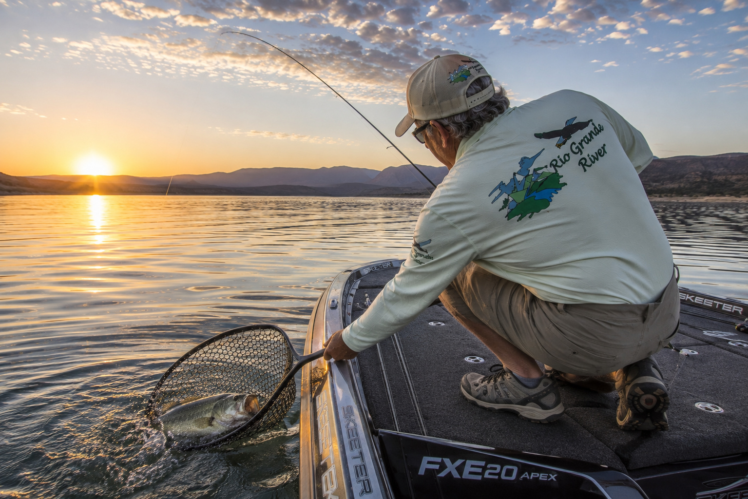
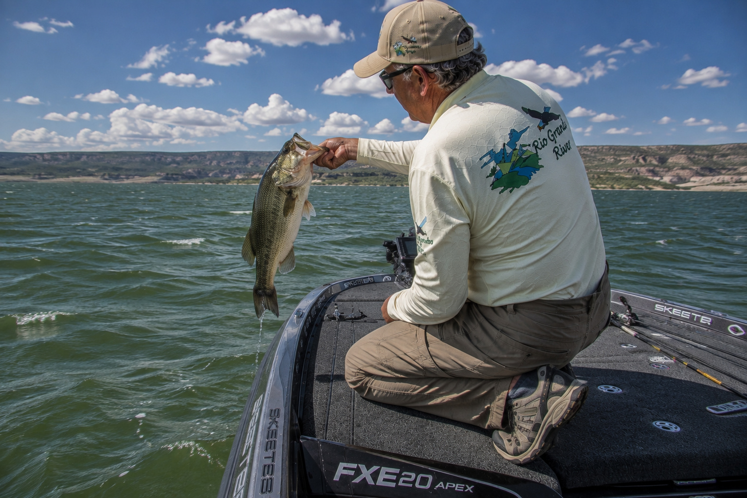
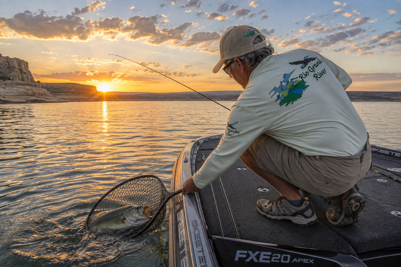
This is where my old bass-fishing instincts begin waking up.Elephant Butte supports largemouth bass, smallmouth bass, white bass, striped bass, crappie, channel and blue catfish, carp and other warm-water species. The current New Mexico fisheries information particularly highlights Elephant Butte for striped and white bass. (NMDOW)It also has history.The current New Mexico state-record striped bass, an extraordinary 54-pound, 8-ounce fish, came from Elephant Butte in 1992. (NMDOW)That is enough striper to make an angler reconsider his knot.
Bass Fishing Elephant Butte
For largemouth and smallmouth bass, I would begin with structure.At low water, especially, structure becomes the map.Look for rocky points, ledges, old creek channels, steep banks, submerged humps and any remaining cover.Largemouth often favor somewhat softer structure and cover.Smallmouth are particularly comfortable around rock.Spring is prime time as water climbs through the 50s and 60s.In summer, early morning and evening become increasingly important.Bass may feed shallow during low light before retreating deeper as that desert sun climbs.
Bass Rods and Baitcasting Reels
I would carry a 7-foot medium-heavy baitcasting rod matched to a smooth low-profile reel for general-purpose fishing.A reel around 6.3:1 to 7.3:1 handles most presentations.For finesse fishing, a 6-foot-10-inch to 7-foot medium spinning rod paired with a 2500-size spinning reel is hard to beat.For crankbaits, I like a rod with a little more moderate action.Treble hooks and broomsticks have never been particularly happy partners.
Fishing Line
My basic bass setups would include:8- to 10-pound fluorocarbon for finesse fishing.10- to 15-pound fluorocarbon for many baitcasting presentations.20- to 30-pound braid where sensitivity or strength matters.Low, clear water makes me more inclined toward lighter line and longer casts.
Bass Lures
I would not arrive without:
- Ned rigsDrop-shot worms4- to 7-inch soft-plastic wormsTubesFootball jigsCraw-style plasticsMedium-diving crankbaitsLipless crankbaitsJerkbaitsSpinnerbaitsSmall swimbaitsTopwater walking baits
Green pumpkin, watermelon, shad patterns and crawfish colors cover an awful lot of circumstances.At dawn, I would absolutely have a topwater tied on.Some habits from my Texas tournament years are difficult to retire.
White Bass and Striped Bass
Elephant Butte becomes even more interesting when we leave the shoreline.New Mexico wildlife biologists describe white bass as schooling predators that often chase shad in open water.Watch the birds.Gulls working over the lake can reveal feeding fish beneath them.When white bass erupt on shad, small spoons, jigs, spinner-jig combinations, minnow plugs and topwaters can all produce.The state recommends ultralight spinning tackle with roughly 6-pound line for white bass. (NMDOW)Stripers require heavier equipment.New Mexico recommends looking for striped bass at Elephant Butte and Caballo in roughly 20 to 50 feet of water, sometimes suspended over much greater depth. Old channels, submerged islands, ridges and adjacent drop-offs are prime areas. (NMDOW)Stripers feed most actively around 70 to 72°F according to the Department's current warm-water guidance. (NMDOW)A depth finder becomes worth its weight in crankbaits.
What About Walleye at Elephant Butte?
Walleye occur within the broader Rio Grande reservoir system, but Caballo is the stronger named walleye destination in current New Mexico fisheries guidance.That is where I would concentrate my walleye effort.So let's continue downstream.
Below Elephant Butte Dam
Below Elephant Butte Dam, the Rio Grande reappears.But this is no longer a river operating entirely according to snowmelt and thunderstorms.Reservoir releases now play a tremendous role.Water leaving Elephant Butte moves approximately 25 miles downstream to Caballo Reservoir. Caballo was built partly to capture water released through Elephant Butte's powerplant during winter and hold it for irrigation delivery during summer. (USBureau of Reclamation)That makes these two reservoirs partners.Elephant Butte is the big storage bank.Caballo is the downstream regulating account.
Caballo Reservoir and Caballo Lake State Park
Caballo Lake sits beneath the rugged Caballo Mountains.It is smaller and quieter than Elephant Butte, but I would never mistake smaller for less interesting.New Mexico State Parks describes Caballo as a destination for motorized boating, kayaking, canoeing, sailing, swimming, fishing, hiking, birding and picnicking. (EMNRD)And for fishermen, Caballo offers something Elephant Butte does not emphasize nearly as strongly.Walleye.
Walleye Fishing Caballo Lake
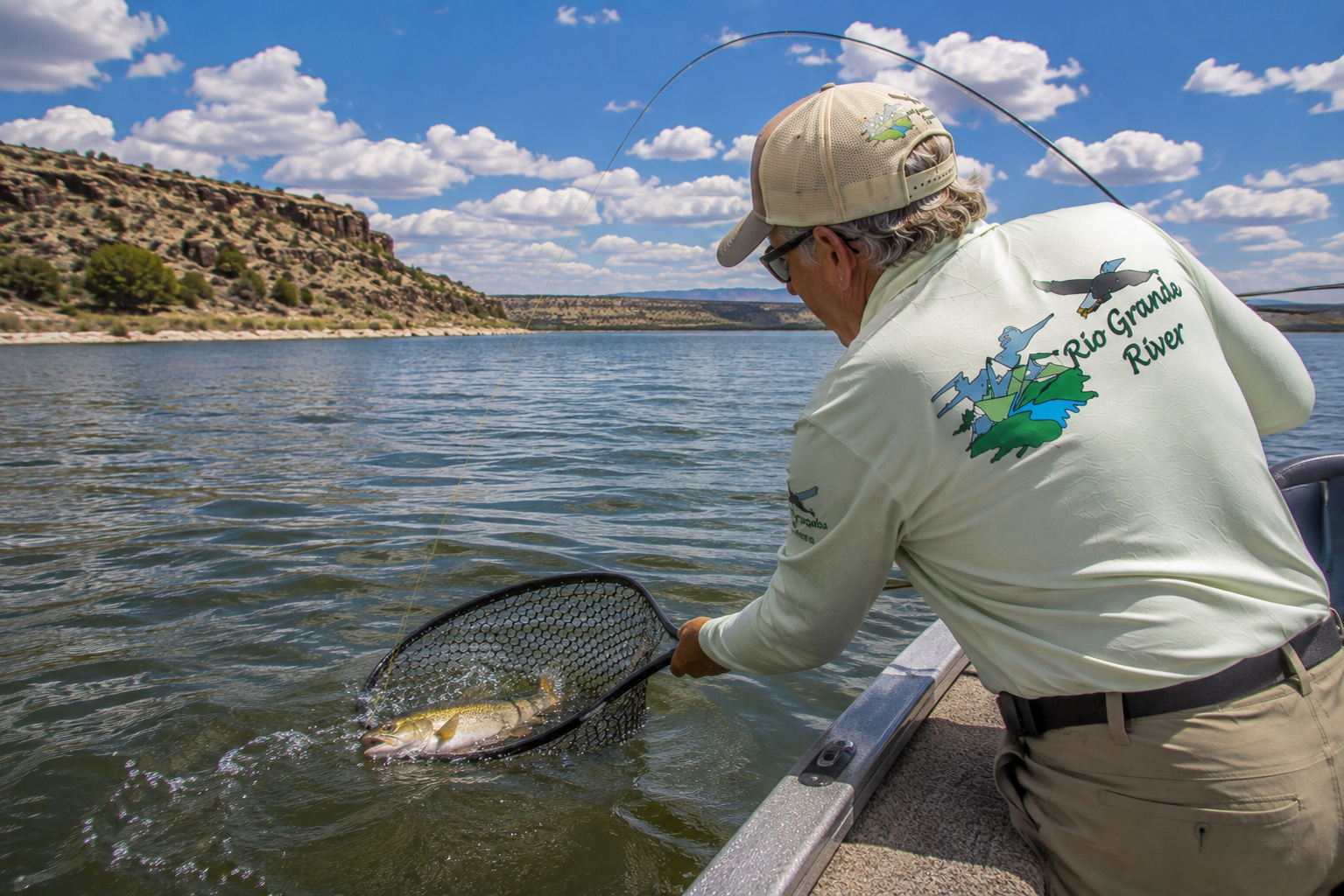
New Mexico fisheries information identifies Caballo Lake as one of the state's better walleye waters, with fishing often best in April and May following the spawn. (NMDOW)I would begin around rocky points, channel edges, humps, drop-offs and flats immediately adjacent to deeper water.Walleye are low-light predators.That makes dawn and dusk especially productive.Cloud cover can extend the bite.Wind can help by breaking up light penetration and concentrating food along windblown structure.
Walleye Spinning Rod and Reel
My basic outfit would be a 6½- to 7-foot medium-light spinning rod with a 2000- or 2500-size reel.Use:6- to 8-pound fluorocarbon, orthin braid with a 6- to 10-pound fluorocarbon leader.Braid provides excellent sensitivity when jigging.And walleye can be surprisingly subtle.Sometimes the bite feels less like a strike and more like somebody quietly hung a wet sock on your jig.Set the hook anyway.
Best Walleye Lures
I would carry:1/8- to 3/8-ounce jigscurly-tail grubspaddle-tail swimbaitsminnow-style crankbaitsjerkbaitsblade baitsand jigging spoons.New Mexico specifically recommends a quarter-ounce jig with a curly-tail grub as a productive walleye presentation.During low light, work shallow-running minnow plugs near shorelines that have immediate access to deeper water.
White Bass, Stripers and Wipers
Caballo also supports white bass and striped bass.And there is an interesting newcomer.Hybrid striped bass, commonly called wipers, have been stocked into Caballo Lake, with state regulations applying the same bag and possession limits as white bass. (NMDOW)These fish are powerful.A wiper combines characteristics of striped and white bass and can turn medium spinning tackle into a surprisingly lively piece of equipment.Look for shad.Look for birds.Look for surface activity.Then get there before the school moves.
Caballo Lake State Park Camping
Caballo is also an excellent base camp.The park currently lists 170 developed campsites, including numerous water-and-electric sites and several full-hookup sites. There are four campgrounds, lakeshore camping, boat-in camping, showers, restrooms and an RV dump station. (EMNRD)As of the state's July 29, 2026 lake-condition update, Caballo's boat ramp was fully operational, although water conditions remain subject to releases and change. (EMNRD)Caballo Lake State Park current informationAt 4,447 feet elevation, Caballo is unmistakably desert country.Summer gets hot.Very hot.Fish early.Photograph early.Hike early.Then find shade.
Below Caballo: The Working Rio Grande
Below Caballo Dam, the river changes again.About two miles downstream lies Percha Diversion Dam.From there to El Paso, the International Boundary and Water Commission's Rio Grande Canalization Project extends about 105.6 miles.The project carries irrigation releases from Elephant Butte and Caballo toward agricultural lands in New Mexico and Texas and helps convey water destined for Mexico under the 1906 Convention. (IBWC)This is important because south of Caballo, the Rio Grande increasingly becomes a managed agricultural river.Flow can vary dramatically by season.During irrigation releases, there may be substantial current.Outside irrigation periods, stretches can become remarkably low.Never assume yesterday's river level tells you what you will see next month.
Las Cruces and the Mesilla Valley
Eventually the river enters the Mesilla Valley.And what a transformation.Desert mountains remain on both sides.The Organ Mountains rise spectacularly east of Las Cruces.But down along the Rio Grande is an agricultural ribbon.Pecan orchards.Chile fields.Cotton.Onions.Alfalfa.Vineyards.Farms and irrigation ditches.This is one of those landscapes where the value of water is visible from the air.Fly over southern New Mexico and you can practically trace the Rio Grande by color.Brown desert.Then green.Then brown again.Water drew the line.
Las Cruces New Mexico
Las Cruces sits just east of the Rio Grande beneath the Organ Mountains.The city has become one of southern New Mexico's major population centers, but its identity remains deeply connected to agriculture and the river.New Mexico State University is here.Old Mesilla is nearby.The Organ Mountains dominate the horizon.White Sands lies beyond the mountains to the east.And the Rio Grande continues south toward Texas.For somebody carrying a camera, Las Cruces offers an almost unfair combination of subjects.Adobe.Mountains.Agriculture.Desert sunsets.And chile.I consider chile a legitimate photographic subject, particularly when somebody has put it on my plate.
Fishing the Rio Grande Below Caballo
River fishing south of Caballo is different from reservoir fishing.Look for current breaks.Bridge pilings.Deeper bends.Diversion structures where access is legal and safe.Tributary mouths after suitable flows.Pools below riffles or constrictions.Channel catfish, carp and other warm-water species become increasingly important.White bass may occur in connected portions of the Rio Grande system.Medium spinning tackle is ideal for much of this fishing.A 6½- to 7-foot medium spinning rod, 2500-size reel and 8- to 12-pound line provide a versatile combination.Small swimbaits, spoons, crankbaits and jigs cover water.For catfish, appropriate natural baits fished on bottom are hard to argue with.
Public Access Along the Southern River
Public access becomes increasingly complicated south of the reservoirs.Some river reaches are bordered by public facilities.Others cross or border private, tribal, municipal or agricultural property.Levees and irrigation infrastructure are not automatically recreational access.Never assume that seeing the river gives you permission to cross the land between you and it.State parks provide the clearest recreational access around Elephant Butte and Caballo.Farther south, use established public access sites and obey posted restrictions.
Camping Along the Route
There are several excellent places to camp during this journey.Elephant Butte Lake State Park has developed and primitive camping, including beach and boat-in opportunities when conditions permit. The park lists 173 developed campsites and extensive RV facilities. (EMNRD)Caballo Lake State Park provides another excellent base with its 170 developed sites. (EMNRD)Farther south, state recreation areas and commercial campgrounds around Truth or Consequences, Las Cruces and the Mesilla Valley offer additional options.I would plan reservations where appropriate and always check current fire restrictions.Southern New Mexico can go from "campfire evening" to "absolutely no open flame" rather quickly.
Weather Along the Rio Grande
Spring
Spring is fishing season.Bass become active as reservoir temperatures rise through the 50s.Walleye fishing at Caballo improves after spawning.White bass begin moving.But spring also brings wind.A calm New Mexico morning can turn into whitecaps by afternoon.Watch forecasts before launching.
Summer
Summer is serious desert weather.Temperatures around Elephant Butte, Caballo, Las Cruces and El Paso can exceed 100°F.Fish from first light through morning.Drink water before you feel thirsty.Wear sun protection.Watch for monsoon thunderstorms.A storm fifty miles away can send runoff down an arroyo that hasn't seen water for weeks.
Autumn
Autumn is one of my favorite seasons.Reservoir water begins cooling.Stripers and white bass may chase shad toward the surface.Days become comfortable.Desert light softens.Cottonwoods along the Rio Grande turn yellow.For fishing and photography, October can be difficult to beat.
Winter
Winter mornings can be surprisingly cold.The desert has a reputation for heat because visitors meet it in July.Meet it before sunrise in January and the desert will correct that misunderstanding.Bosque del Apache becomes especially spectacular as cranes and geese occupy the valley.Reservoir fishing slows, but some species remain catchable.
Points of Interest Along the Rio Grande
This stretch deserves more than a straight drive down Interstate 25.I would stop at Bosque del Apache National Wildlife Refuge for wildlife photography.Truth or Consequences deserves exploration.Elephant Butte Lake deserves several days.Caballo Lake and the Caballo Mountains deserve another.Farther south, consider Fort Selden Historic Site, the Mesilla Valley, historic Mesilla Plaza and the Organ Mountains.The old route of El Camino Real de Tierra Adentro follows much of this river country.That wasn't an accident.Travelers followed water.Before GPS, highways and gas stations, the river itself was the map.
The Pueblo Story Continues South
The Pueblo story does not end at Isleta.The Piro once occupied communities around Socorro and farther south.After the Pueblo Revolt of 1680, migrations and Spanish retreat carried Pueblo people toward the El Paso region.Near modern El Paso, Ysleta del Sur developed from Tiwa people associated with Isleta Pueblo, while the Socorro Mission community carried Piro traditions southward.The National Park Service notes that the permanent Socorro del Sur mission church was built by Piro people in 1691. (National Park Service)So as we travel from Albuquerque to El Paso, we are not merely following water.We are following human movement along water.The two stories cannot be separated.
El Paso Texas
Eventually the Franklin Mountains appear.And there is El Paso.By now we have traveled hundreds of miles from Albuquerque and well over a thousand river miles from the mountains where our journey began.The Rio Grande reaches an international city.On the north bank is El Paso, Texas.Across the river is Ciudad Juárez, Chihuahua.And here the Rio Grande takes on yet another identity.International boundary.From El Paso downstream, much of the river forms the border between the United States and Mexico.The same water that once slipped beneath a fly line near Creede now passes through one of the largest binational metropolitan areas on the continent.That is quite a journey for a snowflake.
Water at El Paso
Anyone arriving expecting a broad, permanently full river may be surprised.Flow through El Paso varies considerably according to irrigation releases, upstream storage, diversions and season.The engineered channel carries irrigation water and international deliveries, and the IBWC notes that the canalized Rio Grande from below Caballo to American Dam at El Paso is designed specifically around these managed flows. (IBWC)Sometimes the river looks substantial.At other times it can be startlingly low.That is the modern Rio Grande.A natural river working inside an enormous human water system.
Getting There
For this entire chapter, Interstate 25 is our backbone.From Albuquerque, I-25 follows the Rio Grande Valley south through or near:BelenSocorroSan AntonioTruth or ConsequencesElephant ButteCaballoHatchand Las Cruces.At Las Cruces, Interstate 10 carries us southeast toward El Paso.But if you simply stay on the interstate, you will miss much of the river.Take the side roads.Visit Bosque del Apache.Drive down to Elephant Butte.Spend a morning at Caballo.Walk through Mesilla.Find a legal public place beside the Rio Grande and turn off the engine.That is when the journey becomes something more than mileage.
A Different Kind of Rio Grande River
By the time Paulette and I reach the El Paso country in my imagination, I have stopped comparing this river with the trout stream we left behind in Colorado.That would be unfair to both of them.Up there, the Rio Grande belonged to snowfields, spruce forests and brown trout.Here it belongs to desert mountains, chile fields, pecan orchards, bass, stripers, walleye, cranes and centuries of irrigation.Same river.Different life.I think that is what has fascinated me most about following the Rio Grande River downstream.It refuses to remain one thing.
One Last Evening Before Texas
If I could choose the final scene for this chapter, I would put Paulette and me somewhere beside the river north of El Paso in late October.The day's heat has gone.The Organ Mountains are behind us.The Franklin Mountains lie ahead.Cottonwoods along the river are catching the last golden sunlight.A great blue heron lifts from the shallows and moves downstream with those slow prehistoric wingbeats.I have my camera.Of course I do.For much of my life I carried a fishing rod whenever I could.These days the camera gets almost equal billing.Perhaps age teaches us to bring home different kinds of trophies.I think about Kansas.The cattle ranches of my boyhood.Houston.Flying airplanes.Building a business.Bass tournaments.Guiding fishermen.Then Angel Fire and seventeen wonderful years looking across the Moreno Valley toward Wheeler Peak and Eagle Nest Lake.Santa Fe.Paulette beside me through more than forty years of all of it.And this river.We began following it high in the mountains.Now Mexico is just across the water.Ahead lies an entirely new chapter.The Rio Grande will turn southeast through Texas.The Pecos will eventually join it.Then comes Big Bend.Amistad.Falcon.The Lower Rio Grande Valley.And finally the Gulf.I watch the current for a while.There isn't much water compared with the river we saw farther north.But what is there keeps moving.Maybe that is one of the reasons rivers appeal to an old fellow.They understand something about time.A river never gets its youth back.It doesn't need to.Every mile gives it another story.And somewhere downstream another bend is waiting.
0 Comments