
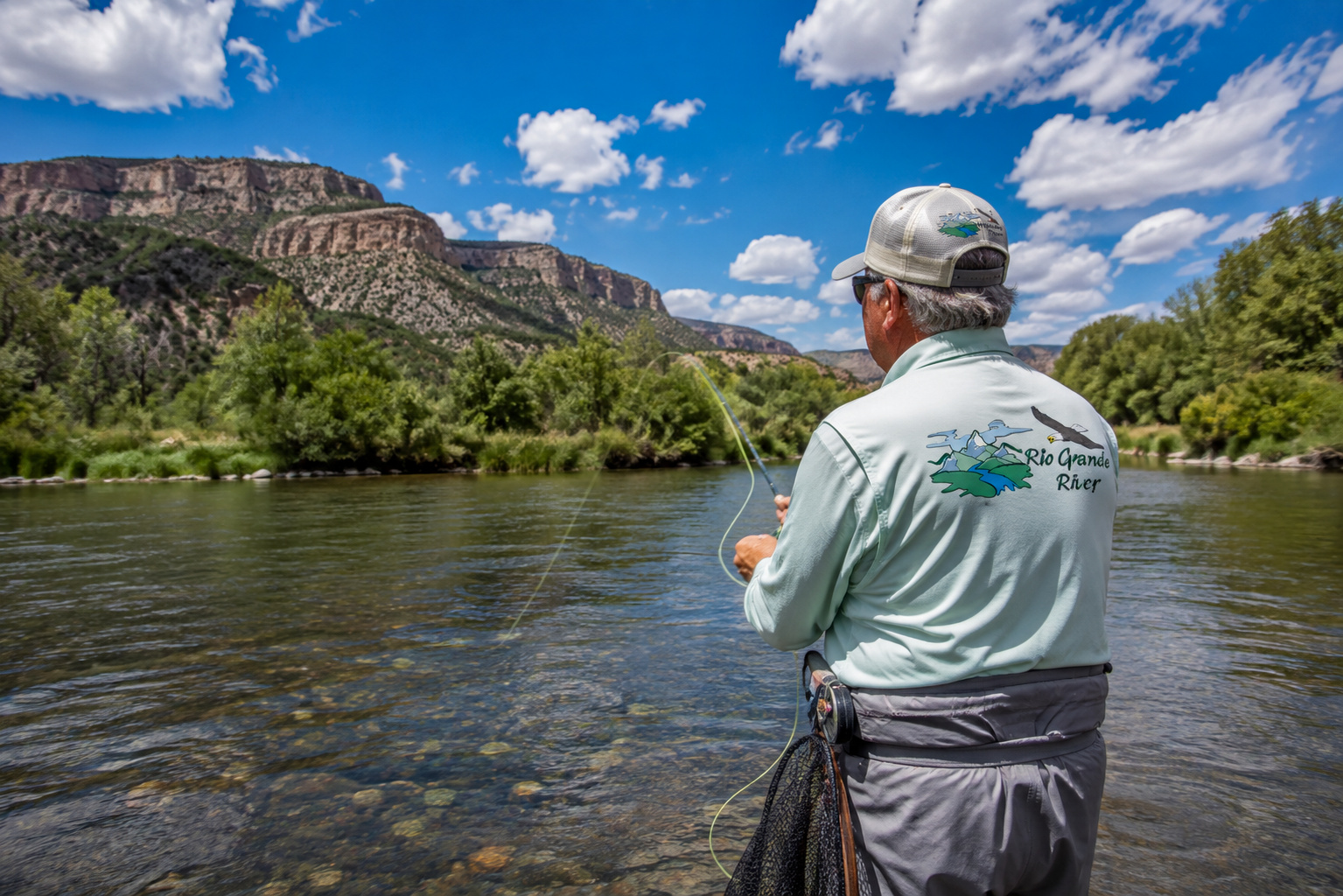
There are rivers you cross, rivers you fish, and rivers you remember.
Then there are rivers that become part of the country itself.
The Rio Grande River belongs in that last category.
I have spent most of my eighty-plus years with an affection for wild country. I grew up on cattle ranches in the Kansas Flint Hills, where a boy learned early that water was never something to take for granted. A stock pond, spring, creek or windmill tank could determine where cattle grazed and how a pasture was used. You watched the sky, noticed the wind, and paid attention when water began running where yesterday there had been only dry grass.
Those lessons have stayed with me.
Many years later, Paulette and I built our log home high in the mountains at Angel Fire, New Mexico. From that mountain country we could look across the Moreno Valley toward Wheeler Peak, Bobcat Pass and Eagle Nest Lake. We spent seventeen wonderful years there surrounded by mountains, forests, wildlife, snow, summer thunderstorms and the clear high-country light that makes northern New Mexico such a remarkable place.
In 2017, we moved to Santa Fe, where we now spend our summers, while winter usually finds us escaping the snow for the desert country around Lake Mohave, Arizona.
Through all those years I have carried cameras, fishing rods and an enduring curiosity about the American Southwest.
And few things tie the Southwest together quite like the Rio Grande.
From snowfields high in Colorado's San Juan Mountains, the river begins an extraordinary journey of roughly 1,900 miles. It crosses alpine country, agricultural valleys, volcanic gorges, Pueblo lands, cities, deserts and some of the loneliest country in North America before finally reaching the sea.
It is simultaneously a trout stream, irrigation source, wildlife corridor, international boundary, recreational river and living thread connecting thousands of years of human history.
So come along with me.
We are going to follow the Rio Grande from the mountains to the Gulf.
Where Does the Rio Grande River Begin?
The Rio Grande begins high in the San Juan Mountains of southwestern Colorado, within the greater Rio Grande headwaters country.
Up there, it does not look much like the enormous river people imagine when they hear the name Rio Grande.
It begins humbly.
Snow accumulates through the Colorado winter. Spring sunshine warms the high slopes. Snowmelt trickles downhill through little rivulets, seeps, wetlands and mountain creeks. Those small waters join others, gradually gathering enough strength to become a recognizable river.
That snow is enormously important.
The U.S. Geological Survey has estimated that more than half of the Rio Grande's streamflow originates as mountain snowmelt in Colorado. That means a winter snowpack hundreds of miles upstream can eventually influence farmers, towns, reservoirs and wildlife far downstream. (USGS)
It is one of the great lessons of Western hydrology:
What happens on a snowy mountain in Colorado does not necessarily stay in Colorado.
A River Nearly 1,900 Miles Long
The National Park Service describes the Rio Grande as approximately 1,885 miles long, running from Colorado through New Mexico and eventually along the Texas-Mexico border before reaching the Gulf. (National Park Service)
Along that journey, the river undergoes one transformation after another.
In Colorado it can be a cold mountain trout river.
In northern New Mexico it cuts through one of the most spectacular volcanic gorges in the Southwest.
Around Española, Cochiti and Albuquerque, cottonwood bosque spreads along its banks.
Farther south, reservoirs capture and redistribute its water.
By the time it reaches Big Bend country, the Rio Grande becomes a ribbon of life winding through the Chihuahuan Desert.
And farther downstream still, it passes through increasingly hot, arid country toward the lower Rio Grande Valley and finally the Gulf.
It is difficult to imagine a single river encompassing more different versions of the Southwest.
The Tributaries That Build the Rio Grande
No great river travels alone.
The Rio Grande is assembled from an enormous family of tributaries, some permanent, some seasonal and some capable of changing dramatically after snowmelt or summer thunderstorms.
Among the important tributaries in the United States are the Rio Chama, Pecos River and Devils River. South of the international border, important Mexican tributaries include the Rio Conchos, Rio Salado and Rio San Juan. (National Park Service)
In northern New Mexico, the Rio Chama is particularly important. Other tributaries and contributing streams throughout the upper watershed include the Conejos, Red River, Rio Pueblo de Taos and numerous mountain creeks.
The hydrology becomes remarkably complicated.
The USGS describes the upper Rio Grande system as a combination of tributary inflows, transmountain diversions, irrigation diversions, agricultural return flows, reservoirs and groundwater exchanges. (USGS Publications)
In other words, the Rio Grande is not simply water flowing downhill.
It is a living water budget.
The Lakes and Reservoirs of the Rio Grande System
Humans have altered the Rio Grande considerably through dams, diversions and reservoirs.
Some reservoirs lie directly on the main stem. Others are part of the greater Rio Grande watershed or water-management system.
Among the best known are:
Elephant Butte Reservoir in southern New Mexico, the great storage reservoir behind Elephant Butte Dam.
Caballo Reservoir, approximately 25 miles downstream from Elephant Butte, stores water released from upstream for later irrigation use. The Bureau of Reclamation lists Caballo Reservoir's capacity at roughly 344,000 acre-feet. (USBureau of Reclamation)
Cochiti Lake, north of Albuquerque, is another major reservoir directly associated with the river.
The broader Rio Grande basin also includes reservoirs such as Heron, El Vado and Abiquiu on the Rio Chama system.
Far downstream stands Amistad Reservoir, created near the confluence of the Rio Grande, Pecos and Devils rivers. The reservoir reaches roughly 73 miles upstream along the Rio Grande itself. (National Park Service)
Still farther downstream is Falcon International Reservoir, another major international impoundment.
These reservoirs provide water storage, irrigation, flood management, recreation and fisheries, but they also fundamentally change the natural rhythm of the river.
Water Levels: Never Assume Yesterday's River Is Today's River
Anyone planning to fish, float or photograph the Rio Grande needs to understand one fundamental fact:
Its flow can change dramatically.
Snowpack, drought, irrigation demand, reservoir releases, thunderstorms and water-management decisions all affect river conditions.
The USGS notes that the Rio Grande has a highly variable streamflow regime and that portions of the river have experienced seasonal drying during drought periods. (USGS)
That variability remains painfully visible in the reservoir system.
As of the Bureau of Reclamation's July 28, 2026 Rio Grande Basin status report, Elephant Butte was listed at only 1 percent of capacity, Caballo at 7 percent, El Vado at 19 percent, Heron at 11 percent and Abiquiu at 48 percent. Those numbers are a snapshot rather than a permanent condition, but they illustrate why current water information matters so much.
Before heading out, I would always check current gauges and reservoir conditions rather than depending on last year's experience.
Ancient Man and the Rio Grande
Long before highways, dams, fishing guides or state boundaries, people were living beside this river.
The human history of the Rio Grande reaches back to the earliest inhabitants of the Southwest. The National Park Service notes that the occupational history along the river and its tributaries extends to the earliest Americans. (National Park Service)
The river eventually became especially important to Ancestral Pueblo peoples.
Communities along the Rio Grande practiced agriculture that included small-scale irrigation as well as dry and floodwater farming. Modern Pueblo communities remain deeply connected to this landscape and are descendants of those ancestral populations. (National Park Service)
Later came Spanish settlers and the development and expansion of acequia agriculture.
Those community irrigation systems became woven into northern New Mexico life. Traditional acequias have been used in the upper Rio Grande watershed for more than four centuries and remain part of the agricultural and cultural landscape today. (National Park Service)
That is something worth remembering when we stand beside the river with a fly rod.
We are newcomers.
People have depended upon these waters for thousands of years.
Fishing the Upper Rio Grande
For a trout fisherman, the upper Rio Grande is an entirely different creature from the river that eventually reaches Texas.
Colorado's upper river flows through classic Rocky Mountain country.
Here an angler can encounter brown trout, rainbow trout and cutthroat trout, with the native Rio Grande cutthroat trout holding a particularly important place in the watershed.
The Rio Grande cutthroat is a beautiful fish, often showing golden-yellow sides, greenish coloration along the back and crimson or orange along the belly.
Unfortunately, its range has declined dramatically. Colorado Parks and Wildlife estimates that Rio Grande cutthroat currently occupy only about 12 percent of their historic habitat. (Colorado Parks and Wildlife)
That alone ought to encourage every angler to handle these fish with respect.
My Spinning Outfit for Rio Grande Trout
There is sometimes an unnecessary division between fly fishermen and spinning fishermen.
I have never seen much point in it.
A good fisherman uses the equipment appropriate for the water, conditions and fish.
For general Rio Grande trout fishing with spinning tackle, I like a 6- to 7-foot light or ultralight spinning rod with a responsive tip.
Match it with a quality 1000- to 2500-size spinning reel.
For line, I prefer:
4- to 6-pound monofilament or fluorocarbon for traditional trout presentations.
A small-diameter braided main line with a fluorocarbon leader can also work well, particularly where longer casts are useful.
In clear mountain water, subtlety usually beats brute force.
Spinning Baits and Lures
Where regulations permit bait, traditional trout offerings can include worms and other legal natural baits.
But I have always enjoyed fooling trout with artificial lures.
Small inline spinners are old-fashioned trout medicine and still catch fish beautifully.
Good choices include:
-
1/16- to 1/4-ounce inline spinners
-
Small spoons
-
1/32- to 1/8-ounce jigs
-
Small minnow-style plugs
-
Trout-sized soft plastics
Natural silver, gold, brown, black, olive and subdued baitfish colors are reliable starting points.
In stained or turbulent water, a little additional flash can help.
Retrieve with the current when possible, allowing the lure to sweep naturally through seams, pockets and current breaks.
Fly Fishing the Rio Grande
A 9-foot 5-weight fly rod is probably the most versatile all-around outfit for much of the Rio Grande.
On smaller headwater tributaries, a shorter 3- or 4-weight can be a delight.
For bigger water, wind and heavier nymph rigs, a 5- or 6-weight gives you additional authority.
Match the rod with an appropriately balanced fly reel and a weight-forward floating fly line.
A fluorocarbon tippet is useful when nymphing, while nylon leaders remain excellent for dry flies.
There is no need to turn trout fishing into an engineering project.
Good presentation still matters more than expensive equipment.
Flies and Nymphs
Rio Grande trout eat what the river gives them.
That means anglers should carry patterns representing mayflies, caddisflies, stoneflies, midges and terrestrial insects.
My basic box would include familiar patterns such as:
Dry flies
Elk Hair Caddis
Parachute Adams
Blue-Winged Olive patterns
Stimulators
Hoppers and ants during terrestrial season
Nymphs
Pheasant Tail
Hare's Ear
Prince Nymph
Copper John
Zebra Midge
Stonefly nymphs
Add a few Woolly Buggers and small streamers and you can cover an extraordinary range of situations without hauling a fly shop around in your vest.
Trout Conservation: Release Them Right
I have been fishing long enough to remember when catch-and-release practices were far less common.
We know better today.
On waters where regulations require it, and whenever I voluntarily release a trout, I want that fish swimming away in good condition.
I strongly favor barbless hooks for catch-and-release trout fishing.
They penetrate well, are considerably easier to remove and reduce the time a trout must be restrained.
Some New Mexico Special Trout Waters specifically require artificial flies or lures using a single barbless hook, so always check the regulations for the water you intend to fish. (NMDOW)
I also follow a few simple practices that can make an enormous difference.
Wet your hands before touching the trout.
Dry hands can damage the protective slime coating that helps defend fish against infection.
Use a rubber landing net.
Rubber mesh is far gentler on trout than traditional abrasive netting and is less likely to tangle hooks.
Keep the trout fully submerged whenever possible.
If I want a photograph, I get the camera ready first. The trout stays in the water until everything is prepared.
Lift briefly.
Take the photograph.
Then return the fish immediately to the water.
No prolonged photo session.
No laying the fish on rocks, sand or dry grass.
When necessary, support the fish gently facing into clean current until it regains balance and strength. Never pump it violently backward and forward.
When the trout can hold itself upright and wants to leave, I let it go.
Watching a good trout disappear back into clear water is one of fishing's finest rewards.
Productive Water Temperatures
Trout are cold-water fish.
As a practical fishing guideline, water from roughly the mid-40s through upper 50s Fahrenheit can provide excellent activity, although conditions vary by species, elevation and season.
Once water temperatures begin approaching the upper 60s, particularly around 68°F and above, trout can become physiologically stressed.
During hot weather I carry a small stream thermometer.
If the river becomes too warm, I quit trout fishing.
There will always be another morning.
A trout released into excessively warm water may swim away and still die later. No fish is worth that.
Best Time of Day
In spring and autumn, productive fishing may occur throughout much of the day.
Summer is different.
Early morning is usually my favorite.
The water has cooled overnight, insects begin moving and trout often feed actively before the sun climbs high.
Evening can produce excellent fishing as temperatures fall.
During hot weather, midday is often better spent under a cottonwood with a sandwich, watching the river.
That is not wasted fishing time.
At my age, I have discovered that lunch beside a trout stream counts as recreation too.
The Rio Grande Gorge
Crossing into northern New Mexico, the Rio Grande enters one of the great landscapes of the Southwest.
The Rio Grande Gorge is dramatic country, cut through volcanic terrain with walls rising high above the river.
The federally designated Rio Grande Wild and Scenic River corridor offers fishing, hiking, camping, wildlife viewing, horseback riding and whitewater boating. (Bureau of Land Management)
Wild Rivers Recreation Area and Orilla Verde Recreation Area provide developed access.
The BLM's Orilla Verde area contains seven campgrounds along with boat launches, picnic facilities and other visitor amenities. (Bureau of Land Management)
BLM Rio Grande Wild and Scenic River information
Boating the Rio Grande
The Rio Grande offers everything from gentle floating water to serious whitewater.
That makes general statements about boating dangerous.
Northern New Mexico's Upper Gorge includes sections ranging from Class II water to the Class V Upper Box, while the Taos Box contains Class III-V rapids. BLM specifically warns that the Taos Box requires expert boating skills. (Bureau of Land Management)
That is not the place to learn rafting by trial and error.
Use a permitted professional outfitter unless you have the training, experience and equipment required for the section.
Flows matter enormously.
A pleasant run at one level can become an entirely different river after runoff or a release.
Farther downstream, boating changes character again as reservoirs and desert reaches replace mountain whitewater.
At Big Bend, anyone placing or operating watercraft on the Rio Grande within the national park must follow NPS river regulations, including applicable permit and personal-flotation-device requirements. (National Park Service)
Public Access
Access along a 1,900-mile river cannot be summarized with one rule.
There is federal land, state land, tribal land, municipal property and private land.
Never assume that seeing water means you have permission to reach it.
In northern New Mexico, BLM recreation areas provide some of the easiest established public access. New Mexico's wildlife agency also maintains an interactive fishing-waters map showing fishing access points, species, facilities, boat ramps and regulations. (NMDOW)
New Mexico Fishing Waters and Access Maps
Respect posted property.
Close gates.
Do not block ranch roads.
Pack out your trash.
The old ranch rule applies perfectly well to public land:
Leave the place at least as good as you found it.
Camping Along the Rio Grande
Camping opportunities change dramatically from Colorado to Texas.
In Colorado's Rio Grande National Forest, campgrounds provide access to mountain sections of the river. Palisade Campground, for example, sits directly along the Rio Grande between Creede and South Fork. (Forest Service)
Northern New Mexico offers developed camping at Wild Rivers and Orilla Verde.
Farther south, opportunities are available around major reservoirs and public recreation areas.
At Amistad National Recreation Area in Texas, boating, fishing, camping and hiking combine with thousands of years of cultural history. (National Park Service)
And Big Bend offers an entirely different camping experience, where desert mountains rise above a river corridor that can seem impossibly green against the surrounding Chihuahuan Desert.
Wildlife Along the River
Follow the Rio Grande south and you follow one of the great wildlife corridors of North America.
In Colorado and northern New Mexico you may encounter elk, mule deer, black bear, coyotes, bobcats, beaver and an extraordinary assortment of birds.
Cottonwood bosque provides crucial habitat farther downstream.
Sandhill cranes and waterfowl use the middle Rio Grande corridor during migration and winter.
Raptors patrol the valley.
Beaver work the banks.
Farther south, desert species become increasingly prominent.
Big Bend National Park alone contains more than 450 bird species, 75 mammal species and 56 reptile species, while the river supports roughly 40 species of fish within the park. (National Park Service)
One of the Rio Grande's most interesting native residents is tiny rather than spectacular.
The endangered Rio Grande silvery minnow once occupied a much larger portion of the watershed. Today its remaining range is greatly reduced, with the U.S. Fish and Wildlife Service reporting populations primarily in the middle Rio Grande between Cochiti Pueblo and the Elephant Butte area. (U.S. Fish and Wildlife Service)
That little fish tells an enormous story about the ecological changes the river has endured.
Weather Along the Rio Grande
You cannot describe Rio Grande weather with a single forecast.
At the headwaters, winters are long and snowy.
Spring brings snowmelt and runoff.
Summer afternoons can produce thunderstorms in the mountains with surprising speed.
Autumn brings cold nights and some of the finest weather of the year.
Northern New Mexico is drier and warmer, but elevation still matters enormously.
By central and southern New Mexico, summer heat becomes a serious consideration.
And by the time the river reaches Big Bend and the lower Texas border country, heat can become dangerous.
Carry more water than you think you will need.
Wear sun protection.
Watch the sky during monsoon season.
Never camp in an arroyo simply because it is dry.
A thunderstorm miles away can send water racing through a drainage beneath a perfectly blue sky.
Getting There
One of the joys of exploring the Rio Grande is that there isn't one destination.
For the Colorado headwaters, travelers generally approach the upper river through South Fork and Creede, with Colorado Highway 149 following spectacular portions of the river.
Northern New Mexico access is available around Questa, Taos, Pilar and Española, with NM 68 providing one of the principal routes along portions of the river corridor.
Around Santa Fe, the river can be reached through several routes toward Española, White Rock, Cochiti and the surrounding country.
Interstate 25 roughly parallels portions of the river valley farther south through Albuquerque, Socorro and toward Las Cruces.
In Texas, US 90 provides access to the Amistad and Del Rio country.
Big Bend requires more deliberate travel, which is part of its charm.
The farther into that country you go, the more civilization seems to loosen its grip.
The Rio Grande Through the Desert
Perhaps nowhere is the Rio Grande more visually striking than where it crosses desert.
At Big Bend, brown water curls beneath towering canyon walls and runs through country where annual rainfall is scarce.
The river creates a narrow green corridor of cottonwoods, willows and other vegetation.
Without it, the landscape would be fundamentally different.
The National Park Service describes the Rio Grande as Big Bend's most prominent water source, supporting fish, turtles, beaver, waterfowl and countless insects within an otherwise arid landscape. (National Park Service)
Standing beside that river in the desert makes its importance impossible to miss.
Amistad and the Lower River
At Amistad, the river becomes something different again.
The limestone landscape produces clear reservoir water, creating opportunities for boating, fishing, swimming and even scuba diving. (National Park Service)
Below Amistad the Rio Grande continues toward Falcon Reservoir and eventually into the Lower Rio Grande Valley.
By then, we are a very long way from those Colorado snowbanks.
The cold mountain trout stream has become a warm-water river.
Fish communities change.
Vegetation changes.
Birdlife changes.
The climate changes.
Yet it remains the same river.
Toward the Gulf of America
Eventually the Rio Grande reaches the coastal plain near Brownsville and Matamoros.
Here its long continental journey approaches its end.
By this point the river has carried snowmelt, storm runoff, sediment and the imprint of countless tributaries through three U.S. states and along an international border.
It has watered farms.
Filled reservoirs.
Carved canyons.
Supported wildlife.
Fed cottonwood forests.
Provided drinking water.
Carried boats.
Produced trout, bass, catfish and countless smaller native fishes.
It has been fought over, divided, dammed, diverted, measured and negotiated.
Yet somehow the river continues toward the sea.
A River Older Than Our Arguments
The older I become, the more I appreciate landscapes that put human affairs into perspective.
The Rio Grande does that.
We debate water rights, state lines, international boundaries, irrigation allocations, reservoirs and regulations.
Those things are important.
But stand quietly beside the river at daylight and another truth becomes apparent.
The river was here before our paperwork.
Ancient people walked these banks long before anyone imagined Colorado, New Mexico, Texas, the United States or Mexico.
Pueblo farmers learned how to live beside it.
Spanish settlers dug acequias from it.
Ranchers depended upon it.
Towns grew beside it.
Wildlife followed it.
And generations of children discovered the irresistible temptation to throw stones into it.
What the Rio Grande Has Taught Me
Growing up in the Kansas Flint Hills taught me to respect land.
Living in the mountains of northern New Mexico deepened that respect.
Photography taught me to look more carefully.
Fishing taught me patience.
Age has taught me that none of these places should ever be taken for granted.
When Paulette and I lived high above the Moreno Valley, I could look toward Wheeler Peak and watch weather moving across those mountains. Snow accumulated during winter and disappeared into the landscape during spring.
Somewhere downstream, that water became part of another person's landscape.
That is what rivers do.
They connect places that appear separate on a highway map.
The Rio Grande connects snowfields and deserts.
Trout and catfish.
Elk country and javelina country.
Pueblo villages and Texas border towns.
Mountain campgrounds and desert canyons.
Ancient history and tomorrow morning.
One River, One Remarkable Journey
If you ever have the opportunity, don't experience the Rio Grande in only one place.
See its beginnings in Colorado.
Fish its cold upper reaches.
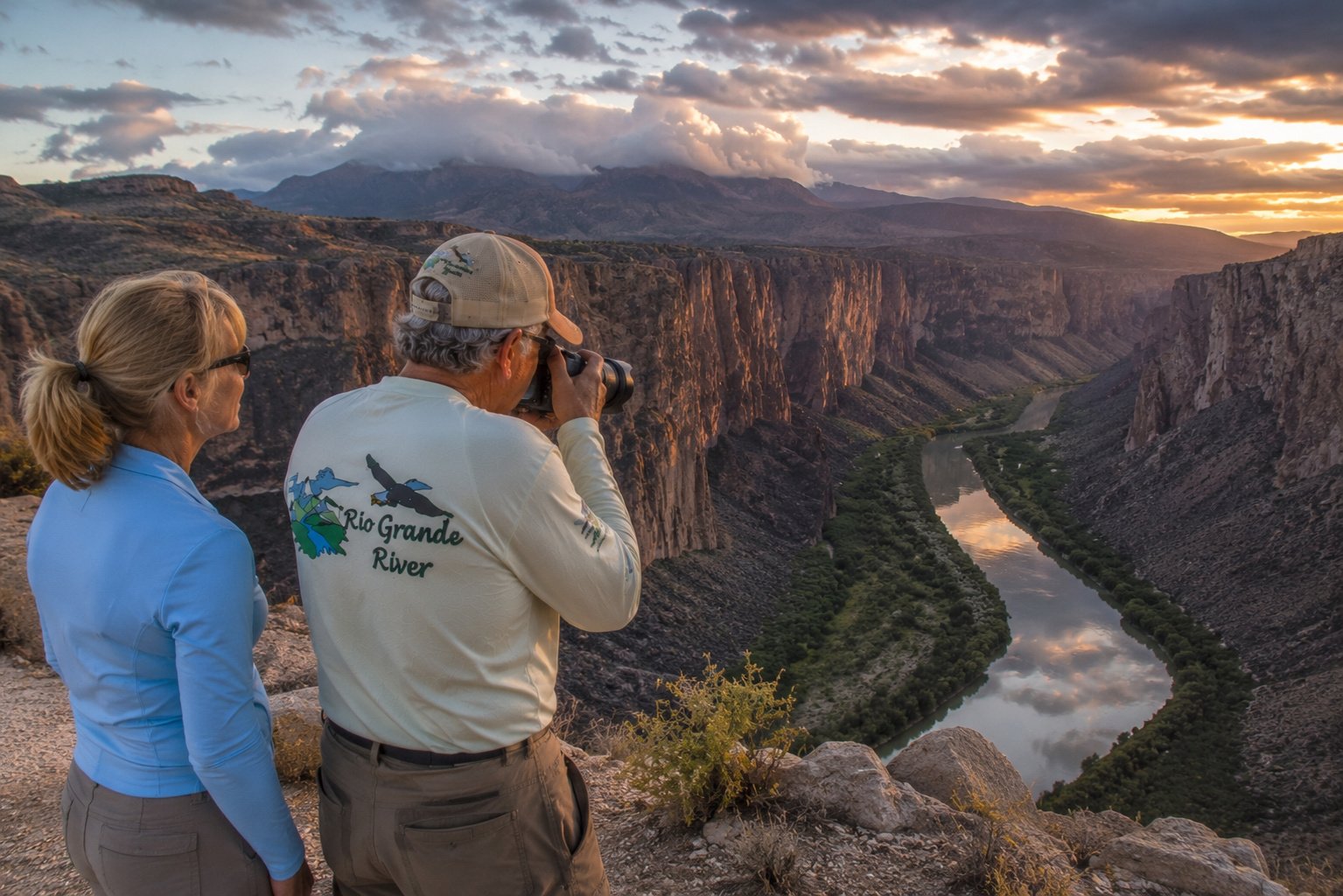
Stand on the rim of the Rio Grande Gorge.
Camp beside it in northern New Mexico.
Walk beneath cottonwoods in the bosque.
Visit Elephant Butte and consider how much Western life depends upon stored water.
See the clear blue immensity of Amistad.
Float through Big Bend if you have the opportunity and proper experience.
And someday, stand near the lower river where this extraordinary journey finally reaches the Gulf.
Bring a camera.
Bring binoculars.
Bring a fishing rod when appropriate.
And bring enough time to sit quietly.
If you catch a trout, use a barbless hook.
Land it in a rubber net.
Touch it only with wet hands.
Keep it fully submerged as much as possible.
Let it recover in cool, clean water.
Then loosen your hands and watch it swim away.
There is something fitting about releasing a trout into the Rio Grande.
The fish disappears into the current, and the current disappears around the bend.
Neither belongs entirely to us.
For nearly 1,900 miles, from the high San Juan Mountains to the sea, the Rio Grande reminds us of something those of us raised close to the land learned a long time ago:
Take care of the water, and the water will take care of a remarkable amount of life.
Pat is a writer, photographer, and videographer documenting the wilderness and wildlife of the American Southwest. His work focuses on the mountains, deserts, rivers, and trails of New Mexico, Arizona, Utah, and Colorado. He and his wife Paulette divide their time between Santa Fe, New Mexico and Lake Mohave, Arizona.

0 Comments